National Register of Historic Places listings in McDowell County, West Virginia
National Register of Historic Places listings in McDowell County, West Virginia
Jump to navigation
Jump to search

Location of McDowell County in West Virginia
This is a list of the National Register of Historic Places listings in McDowell County, West Virginia.
This is intended to be a complete list of the properties and districts on the National Register of Historic Places in McDowell County, West Virginia, United States. The locations of National Register properties and districts for which the latitude and longitude coordinates are included below, may be seen in a Google map.[1]
There are 17 properties and districts listed on the National Register in the county. Most of these locations are the former company stores of coal companies.
This National Park Service list is complete through NPS recent listings posted November 16, 2018.[2]
Barbour - |
Current listings[edit]
| [3] | Name on the Register | Image | Date listed[4] | Location | City or town | Description |
|---|---|---|---|---|---|---|
1 | Algoma Coal and Coke Company Store |  | April 17, 1992 (#92000323) | County Route 17 37°25′10″N 81°25′35″W / 37.419444°N 81.426389°W / 37.419444; -81.426389 (Algoma Coal and Coke Company Store) | Algoma | |
2 | Ashland Company Store |  | May 5, 2005 (#05000399) | County Route 17 37°24′33″N 81°21′14″W / 37.409167°N 81.353889°W / 37.409167; -81.353889 (Ashland Company Store) | Ashland | |
3 | Carter Coal Company Store | April 17, 1992 (#92000329) | Junction of WV 16 and County Route 12/8 37°20′01″N 81°40′28″W / 37.333611°N 81.674444°W / 37.333611; -81.674444 (Carter Coal Company Store) | Caretta | ||
4 | Carter Coal Company Store |  | April 17, 1992 (#92000328) | County Route 2 37°23′14″N 81°39′06″W / 37.387222°N 81.651667°W / 37.387222; -81.651667 (Carter Coal Company Store) | Coalwood | Demolished March 29, 2008.[5] |
5 | Empire Coal Company Store |  | April 17, 1992 (#92000321) | U.S. Route 52 37°24′43″N 81°28′28″W / 37.411944°N 81.474444°W / 37.411944; -81.474444 (Empire Coal Company Store) | Landgraff | No longer extant.[6] |
6 | Houston Coal Company Store |  | April 17, 1992 (#92000331) | U.S. Route 52 37°25′48″N 81°30′32″W / 37.43°N 81.508889°W / 37.43; -81.508889 (Houston Coal Company Store) | Carswell | |
7 | James Ellwood Jones House |  | April 2, 1992 (#92000306) | North of U.S. Route 52, east of Turkey Gap Branch 37°22′17″N 81°22′52″W / 37.371389°N 81.381111°W / 37.371389; -81.381111 (James Ellwood Jones House) | Switchback | |
8 | John J. Lincoln House | July 16, 1992 (#92000900) | North of U.S. Route 52 37°23′07″N 81°24′46″W / 37.385278°N 81.412778°W / 37.385278; -81.412778 (John J. Lincoln House) | Elkhorn | ||
9 | McDowell County Courthouse |  | August 29, 1979 (#79003256) | Wyoming St. 37°25′57″N 81°35′03″W / 37.4325°N 81.584167°W / 37.4325; -81.584167 (McDowell County Courthouse) | Welch | |
10 | Page Coal and Coke Company Store |  | April 17, 1992 (#92000325) | WV 161 37°20′57″N 81°27′53″W / 37.349167°N 81.464722°W / 37.349167; -81.464722 (Page Coal and Coke Company Store) | Pageton | |
11 | Peerless Coal Company Store |  | April 17, 1992 (#92000322) | South of U.S. Route 52 37°25′03″N 81°29′26″W / 37.4175°N 81.490556°W / 37.4175; -81.490556 (Peerless Coal Company Store) | Vivian | |
12 | Pocahontas Fuel Company Store |  | April 17, 1992 (#92000324) | U.S. Route 52 37°22′32″N 81°21′48″W / 37.375694°N 81.363333°W / 37.375694; -81.363333 (Pocahontas Fuel Company Store) | Maybeury | Demolished sometime after March 2005.[7] |
13 | Pocahontas Fuel Company Store | April 17, 1992 (#92000330) | U.S. Route 52 37°22′14″N 81°23′04″W / 37.370417°N 81.384583°W / 37.370417; -81.384583 (Pocahontas Fuel Company Store) | Switchback | ||
14 | Pocahontas Fuel Company Store and Office Buildings |  | April 17, 1992 (#92000326) | County Route 8 37°17′28″N 81°25′25″W / 37.291111°N 81.423611°W / 37.291111; -81.423611 (Pocahontas Fuel Company Store and Office Buildings) | Jenkinjones | |
15 | U.S. Coal and Coke Company Store |  | April 17, 1992 (#92000327) | County Route 13/2 37°21′05″N 81°32′51″W / 37.351389°N 81.5475°W / 37.351389; -81.5475 (U.S. Coal and Coke Company Store) | Ream | Demolished sometime between March 2004 and 2006.[7] |
16 | Welch Commercial Historic District | 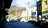 | April 2, 1992 (#92000305) | Roughly bounded by Wyoming St., Elkhorn Creek and the Tug River 37°25′57″N 81°35′08″W / 37.4325°N 81.585556°W / 37.4325; -81.585556 (Welch Commercial Historic District) | Welch | |
17 | World War Memorial |  | April 9, 1993 (#93000227) | U.S. Route 52 37°25′31″N 81°30′24″W / 37.425278°N 81.506667°W / 37.425278; -81.506667 (World War Memorial) | Kimball |
See also[edit]
| Wikimedia Commons has media related to National Register of Historic Places in McDowell County, West Virginia. |
- List of National Historic Landmarks in West Virginia
- National Register of Historic Places listings in West Virginia
References[edit]
^ The latitude and longitude information provided in this table was derived originally from the National Register Information System, which has been found to be fairly accurate for about 99% of listings. For about 1% of NRIS original coordinates, experience has shown that one or both coordinates are typos or otherwise extremely far off; some corrections may have been made. A more subtle problem causes many locations to be off by up to 150 yards, depending on location in the country: most NRIS coordinates were derived from tracing out latitude and longitudes from USGS topographical quadrant maps created under the North American Datum of 1927, which differs from the current, highly accurate WGS84 GPS system used by most on-line maps. Chicago is about right, but NRIS longitudes in Washington are higher by about 4.5 seconds, and are lower by about 2.0 seconds in Maine. Latitudes differ by about 1.0 second in Florida. Some locations in this table may have been corrected to current GPS standards.
^ "National Register of Historic Places: Weekly List Actions". National Park Service, United States Department of the Interior. Retrieved on November 16, 2018.
^ Numbers represent an ordering by significant words. Various colorings, defined here, differentiate National Historic Landmarks and historic districts from other NRHP buildings, structures, sites or objects.
^ The eight-digit number below each date is the number assigned to each location in the National Register Information System database, which can be viewed by clicking the number.
^ "Coalwood". Archived from the original on March 16, 2010. Retrieved March 16, 2010..mw-parser-output cite.citation{font-style:inherit}.mw-parser-output q{quotes:"""""""'""'"}.mw-parser-output code.cs1-code{color:inherit;background:inherit;border:inherit;padding:inherit}.mw-parser-output .cs1-lock-free a{background:url("//upload.wikimedia.org/wikipedia/commons/thumb/6/65/Lock-green.svg/9px-Lock-green.svg.png")no-repeat;background-position:right .1em center}.mw-parser-output .cs1-lock-limited a,.mw-parser-output .cs1-lock-registration a{background:url("//upload.wikimedia.org/wikipedia/commons/thumb/d/d6/Lock-gray-alt-2.svg/9px-Lock-gray-alt-2.svg.png")no-repeat;background-position:right .1em center}.mw-parser-output .cs1-lock-subscription a{background:url("//upload.wikimedia.org/wikipedia/commons/thumb/a/aa/Lock-red-alt-2.svg/9px-Lock-red-alt-2.svg.png")no-repeat;background-position:right .1em center}.mw-parser-output .cs1-subscription,.mw-parser-output .cs1-registration{color:#555}.mw-parser-output .cs1-subscription span,.mw-parser-output .cs1-registration span{border-bottom:1px dotted;cursor:help}.mw-parser-output .cs1-hidden-error{display:none;font-size:100%}.mw-parser-output .cs1-visible-error{font-size:100%}.mw-parser-output .cs1-subscription,.mw-parser-output .cs1-registration,.mw-parser-output .cs1-format{font-size:95%}.mw-parser-output .cs1-kern-left,.mw-parser-output .cs1-kern-wl-left{padding-left:0.2em}.mw-parser-output .cs1-kern-right,.mw-parser-output .cs1-kern-wl-right{padding-right:0.2em}
^ "Aerial Photography of Empire Coal Company Store Site". Google Maps. Google. Retrieved April 27, 2010.
^ ab Dellamea, Chris. "Flat Top Field - McDowell County". Coalfields of the Appalachian Mountains. Retrieved April 27, 2010.
U.S. National Register of Historic Places in West Virginia | ||
|---|---|---|
| Topics |
|  |
| Lists by county |
| |
| Other lists |
| |
| ||
Municipalities and communities of McDowell County, West Virginia, United States | ||
|---|---|---|
County seat: Welch | ||
| Cities |
|  |
| Towns |
| |
| CDPs |
| |
| Unincorporated communities |
| |
| Ghost town |
| |
| Footnotes | ‡This populated place also has portions in an adjacent county or counties | |
Categories:
- National Register of Historic Places in McDowell County, West Virginia
- Lists of National Register of Historic Places in West Virginia by county
(window.RLQ=window.RLQ||).push(function(){mw.config.set({"wgPageParseReport":{"limitreport":{"cputime":"0.532","walltime":"0.685","ppvisitednodes":{"value":7518,"limit":1000000},"ppgeneratednodes":{"value":0,"limit":1500000},"postexpandincludesize":{"value":168269,"limit":2097152},"templateargumentsize":{"value":14201,"limit":2097152},"expansiondepth":{"value":10,"limit":40},"expensivefunctioncount":{"value":0,"limit":500},"unstrip-depth":{"value":1,"limit":20},"unstrip-size":{"value":11322,"limit":5000000},"entityaccesscount":{"value":1,"limit":400},"timingprofile":["100.00% 485.280 1 -total"," 44.91% 217.925 17 Template:NRHP_row"," 19.95% 96.827 1 Template:Reflist"," 15.82% 76.754 3 Template:Cite_web"," 14.62% 70.935 1 Template:Commons_category"," 11.83% 57.410 17 Template:Dts"," 10.52% 51.071 23 Template:NRHP_color"," 9.95% 48.282 18 Template:Designation/color"," 8.60% 41.747 35 Template:First_word"," 8.50% 41.247 17 Template:Coord"]},"scribunto":{"limitreport-timeusage":{"value":"0.181","limit":"10.000"},"limitreport-memusage":{"value":3571033,"limit":52428800}},"cachereport":{"origin":"mw1330","timestamp":"20181122004800","ttl":1900800,"transientcontent":false}}});mw.config.set({"wgBackendResponseTime":806,"wgHostname":"mw1330"});});


