Shire of Wickepin
Shire of Wickepin
Jump to navigation
Jump to search
Shire of Wickepin Western Australia | |||||||||||||||
|---|---|---|---|---|---|---|---|---|---|---|---|---|---|---|---|
 Wickepin Town Hall, 2014 | |||||||||||||||
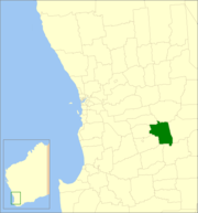 Location in Western Australia | |||||||||||||||
| Population | 750 (2013 est)[1] | ||||||||||||||
| • Density | 0.3674/km2 (0.951/sq mi) | ||||||||||||||
| Established | 1909 | ||||||||||||||
| Area | 2,041.6 km2 (788.3 sq mi) | ||||||||||||||
| President | Julie Russell | ||||||||||||||
| Council seat | Wickepin | ||||||||||||||
| Region | Wheatbelt | ||||||||||||||
| State electorate(s) | Roe | ||||||||||||||
| Federal Division(s) | O'Connor | ||||||||||||||
| Website | Shire of Wickepin | ||||||||||||||
| |||||||||||||||
The Shire of Wickepin is a local government area in the Wheatbelt region of Western Australia, east of Narrogin and about 220 kilometres (137 mi) southeast of the state capital, Perth. The Shire covers an area of 2,042 square kilometres (788 sq mi), and its seat of government is the town of Wickepin.
Contents
1 History
2 Wards
3 Towns and localities
4 Population
5 References
6 External links
History[edit]
In 1909, the Wickepin Road District was created. The Road Board consisted of a chairman, secretary and seven members. On 1 July 1961, it became a shire under the Local Government Act 1960.[2]
Wards[edit]
The Shire is at present undivided with its nine councillors representing the entire shire.
Until 20 October 2007 the shire was divided into 5 wards:
- Townsite Ward (2 councillors)
- North Ward (2 councillors)
- Central Ward (2 councillors)
- South Ward (2 councillors)
- East Ward (1 councillor)
Towns and localities[edit]
- Wickepin
- Gillimanning
- Harrismith
- Malyalling
- Tincurrin
- Toolibin
- Wogolin
- Yealering
Population[edit]
| Year | Population |
|---|---|
| 1911 | 1,146 |
| 1921 | 1,454 |
| 1933 | 1,598 |
| 1947 | 1,153 |
| 1954 | 1,334 |
| 1961 | 1,276 |
| 1966 | 1,380 |
| 1971 | 1,144 |
| 1976 | 1,076 |
| 1981 | 1,018 |
| 1986 | 951 |
| 1991 | 915 |
| 1996 | 833 |
| 2001 | 713 |
| 2006 | 716 |
References[edit]
^ "3218.0 Regional Population Growth, Australia. Table 5. Estimated Resident Population, Local Government Areas, Western Australia". 3 April 2014. Retrieved 11 September 2014..mw-parser-output cite.citation{font-style:inherit}.mw-parser-output q{quotes:"""""""'""'"}.mw-parser-output code.cs1-code{color:inherit;background:inherit;border:inherit;padding:inherit}.mw-parser-output .cs1-lock-free a{background:url("//upload.wikimedia.org/wikipedia/commons/thumb/6/65/Lock-green.svg/9px-Lock-green.svg.png")no-repeat;background-position:right .1em center}.mw-parser-output .cs1-lock-limited a,.mw-parser-output .cs1-lock-registration a{background:url("//upload.wikimedia.org/wikipedia/commons/thumb/d/d6/Lock-gray-alt-2.svg/9px-Lock-gray-alt-2.svg.png")no-repeat;background-position:right .1em center}.mw-parser-output .cs1-lock-subscription a{background:url("//upload.wikimedia.org/wikipedia/commons/thumb/a/aa/Lock-red-alt-2.svg/9px-Lock-red-alt-2.svg.png")no-repeat;background-position:right .1em center}.mw-parser-output .cs1-subscription,.mw-parser-output .cs1-registration{color:#555}.mw-parser-output .cs1-subscription span,.mw-parser-output .cs1-registration span{border-bottom:1px dotted;cursor:help}.mw-parser-output .cs1-hidden-error{display:none;font-size:100%}.mw-parser-output .cs1-visible-error{font-size:100%}.mw-parser-output .cs1-subscription,.mw-parser-output .cs1-registration,.mw-parser-output .cs1-format{font-size:95%}.mw-parser-output .cs1-kern-left,.mw-parser-output .cs1-kern-wl-left{padding-left:0.2em}.mw-parser-output .cs1-kern-right,.mw-parser-output .cs1-kern-wl-right{padding-right:0.2em}
^ WA Electoral Commission, Municipality Boundary Amendments Register (release 3.0), 31 July 2007.
External links[edit]
![]() Media related to Shire of Wickepin at Wikimedia Commons
Media related to Shire of Wickepin at Wikimedia Commons
Official website
Coordinates: 32°46′48″S 117°30′18″E / 32.780°S 117.505°E / -32.780; 117.505
Categories:
- Populated places established in 1909
- 1909 establishments in Australia
- Local government areas of the Wheatbelt region of Western Australia
(window.RLQ=window.RLQ||).push(function(){mw.config.set({"wgPageParseReport":{"limitreport":{"cputime":"0.396","walltime":"0.472","ppvisitednodes":{"value":1907,"limit":1000000},"ppgeneratednodes":{"value":0,"limit":1500000},"postexpandincludesize":{"value":75145,"limit":2097152},"templateargumentsize":{"value":2450,"limit":2097152},"expansiondepth":{"value":12,"limit":40},"expensivefunctioncount":{"value":3,"limit":500},"unstrip-depth":{"value":1,"limit":20},"unstrip-size":{"value":3298,"limit":5000000},"entityaccesscount":{"value":1,"limit":400},"timingprofile":["100.00% 369.850 1 -total"," 29.42% 108.796 1 Template:Infobox_Australian_place"," 26.48% 97.940 1 Template:Reflist"," 24.19% 89.471 1 Template:Cite_web"," 17.49% 64.691 1 Template:Infobox"," 11.20% 41.416 2 Template:Convert"," 10.39% 38.427 1 Template:About"," 10.04% 37.150 2 Template:Navbox"," 8.49% 31.411 1 Template:Local_Government_Areas_of_Western_Australia"," 7.47% 27.643 1 Template:Commonscat-inline"]},"scribunto":{"limitreport-timeusage":{"value":"0.165","limit":"10.000"},"limitreport-memusage":{"value":4701410,"limit":52428800}},"cachereport":{"origin":"mw1317","timestamp":"20181013232459","ttl":1900800,"transientcontent":false}}});mw.config.set({"wgBackendResponseTime":84,"wgHostname":"mw1265"});});

 Clash Royale CLAN TAG