Shire of Merredin
Shire of Merredin
Jump to navigation
Jump to search
Shire of Merredin Western Australia | |||||||||||||||
|---|---|---|---|---|---|---|---|---|---|---|---|---|---|---|---|
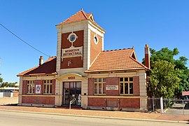 Merredin District Hall, 2014 | |||||||||||||||
 Location in Western Australia | |||||||||||||||
| Population | 3,300 (2013 est)[1] | ||||||||||||||
| • Density | 1.000/km2 (2.59/sq mi) | ||||||||||||||
| Area | 3,299.7 km2 (1,274.0 sq mi) | ||||||||||||||
| Mayor | Ken Hooper | ||||||||||||||
| Council seat | Merredin | ||||||||||||||
| Region | Wheatbelt | ||||||||||||||
| State electorate(s) | Central Wheatbelt | ||||||||||||||
| Federal Division(s) | Durack, O'Connor | ||||||||||||||
| Website | Shire of Merredin | ||||||||||||||
| |||||||||||||||
The Shire of Merredin is a local government area in the Wheatbelt region of Western Australia, about 250 kilometres (155 mi) east of Perth, the state capital. Its seat of government is the town of Merredin, where 2,804 of the Shire's 3,595 residents live. The Shire covers an area of 3,300 square kilometres (1,274 sq mi).
Contents
1 History
2 Wards
3 Towns and localities
4 Population
5 Notable councillors
6 References
7 External links
History[edit]
On 30 June 1921, the Merredin Road District was created. On 1 July 1961, it became a shire under the Local Government Act 1960.[2]
Wards[edit]
On 3 May 2003, all wards were abolished and all 11 councillors sit at large.
Prior to this, the ward structure was as follows:
- Central Ward (7 councillors)
- North West Ward
- North East Ward
- South West Ward
- Totadgin Ward
Towns and localities[edit]
- Merredin
- Booraan
- Burracoppin
- Hines Hill
- Korbel
- Muntadgin
- Nangeenan
- Nokaning
- Norpa
- Nukarni
- Tandegin
Population[edit]
| Year | Population |
|---|---|
| 1921 | 2,799 |
| 1933 | 3,445 |
| 1947 | 3,023 |
| 1954 | 3,797 |
| 1961 | 4,563 |
| 1966 | 5,297 |
| 1971 | 4,693 |
| 1976 | 4,730 |
| 1981 | 4,525 |
| 1986 | 4,177 |
| 1991 | 3,802 |
| 1996 | 3,634 |
| 2001 | 3,595 |
| 2006 | 3,245 |
| 2011 | 3,282 |
Notable councillors[edit]
William Telfer, Merredin Roads Board member 1936–1955, chairman 1938–1955; also a state MP
References[edit]
^ "3218.0 Regional Population Growth, Australia. Table 5. Estimated Resident Population, Local Government Areas, Western Australia". 3 April 2014. Retrieved 11 September 2014..mw-parser-output cite.citation{font-style:inherit}.mw-parser-output q{quotes:"""""""'""'"}.mw-parser-output code.cs1-code{color:inherit;background:inherit;border:inherit;padding:inherit}.mw-parser-output .cs1-lock-free a{background:url("//upload.wikimedia.org/wikipedia/commons/thumb/6/65/Lock-green.svg/9px-Lock-green.svg.png")no-repeat;background-position:right .1em center}.mw-parser-output .cs1-lock-limited a,.mw-parser-output .cs1-lock-registration a{background:url("//upload.wikimedia.org/wikipedia/commons/thumb/d/d6/Lock-gray-alt-2.svg/9px-Lock-gray-alt-2.svg.png")no-repeat;background-position:right .1em center}.mw-parser-output .cs1-lock-subscription a{background:url("//upload.wikimedia.org/wikipedia/commons/thumb/a/aa/Lock-red-alt-2.svg/9px-Lock-red-alt-2.svg.png")no-repeat;background-position:right .1em center}.mw-parser-output .cs1-subscription,.mw-parser-output .cs1-registration{color:#555}.mw-parser-output .cs1-subscription span,.mw-parser-output .cs1-registration span{border-bottom:1px dotted;cursor:help}.mw-parser-output .cs1-hidden-error{display:none;font-size:100%}.mw-parser-output .cs1-visible-error{font-size:100%}.mw-parser-output .cs1-subscription,.mw-parser-output .cs1-registration,.mw-parser-output .cs1-format{font-size:95%}.mw-parser-output .cs1-kern-left,.mw-parser-output .cs1-kern-wl-left{padding-left:0.2em}.mw-parser-output .cs1-kern-right,.mw-parser-output .cs1-kern-wl-right{padding-right:0.2em}
^ WA Electoral Commission, Municipality Boundary Amendments Register (release 3.0), 31 July 2007.
External links[edit]
![]() Media related to Shire of Merredin at Wikimedia Commons
Media related to Shire of Merredin at Wikimedia Commons
Official website
Coordinates: 31°28′59″S 118°17′10″E / 31.483°S 118.286°E / -31.483; 118.286
Categories:
- Shire of Merredin
(window.RLQ=window.RLQ||).push(function(){mw.config.set({"wgPageParseReport":{"limitreport":{"cputime":"0.316","walltime":"0.410","ppvisitednodes":{"value":2074,"limit":1000000},"ppgeneratednodes":{"value":0,"limit":1500000},"postexpandincludesize":{"value":76193,"limit":2097152},"templateargumentsize":{"value":2839,"limit":2097152},"expansiondepth":{"value":12,"limit":40},"expensivefunctioncount":{"value":2,"limit":500},"unstrip-depth":{"value":1,"limit":20},"unstrip-size":{"value":3298,"limit":5000000},"entityaccesscount":{"value":1,"limit":400},"timingprofile":["100.00% 320.958 1 -total"," 25.24% 81.021 1 Template:Infobox_Australian_place"," 22.99% 73.802 1 Template:Reflist"," 21.25% 68.214 1 Template:Cite_web"," 16.22% 52.056 1 Template:Infobox"," 12.42% 39.853 2 Template:Navbox"," 10.33% 33.163 1 Template:Local_Government_Areas_of_Western_Australia"," 8.70% 27.928 1 Template:About"," 8.20% 26.312 2 Template:Convert"," 8.12% 26.048 1 Template:Commonscat-inline"]},"scribunto":{"limitreport-timeusage":{"value":"0.127","limit":"10.000"},"limitreport-memusage":{"value":5024781,"limit":52428800}},"cachereport":{"origin":"mw1248","timestamp":"20181014023200","ttl":1900800,"transientcontent":false}}});mw.config.set({"wgBackendResponseTime":80,"wgHostname":"mw1249"});});

 Clash Royale CLAN TAG

