Harvey (rehiyon)
Tiganos: 33°08′59″S 115°56′02″E / 33.14976°S 115.93376°Ö / -33.14976; 115.93376
Harvey (rehiyon)
Jump to navigation
Jump to search
| Paghimo ni bot Lsjbot. |
- Alang sa ubang mga dapit sa mao gihapon nga ngalan, tan-awa ang Harvey.
| Harvey | |
| Rehiyon | |
| Nasod | |
|---|---|
| Estado | State of Western Australia |
| Gitas-on | 222 m (728 ft) |
| Tiganos | 33°08′59″S 115°56′02″E / 33.14976°S 115.93376°Ö / -33.14976; 115.93376 |
| Population | 25,924 (2014-07-26) [1] |
| Timezone | AWST (UTC+8) |
| GeoNames | 7839514 |
Rehiyon ang Harvey sa Awstralya.[1] Nahimutang ni sa estado sa State of Western Australia, sa kasadpang bahin sa nasod, 3,000 km sa kasadpan sa Canberra ang ulohan sa nasod. Adunay 25,924 ka molupyo.[1]
Mga lungsod sa Harvey:
- Australind
- Harvey
- Binningup
- Roelands
- Burekup
- Yarloop
- Wokalup
- Cookernup
Sa mosunod nga mga natural nga mga bahin makita sa Harvey:
- Mga bungtod:
Aylesbury Hill (bungtod)
Bedford Hill (bungtod)
Dingo Knob (bungtod)
Hill 60 (bungtod)
Leeds Hill (bungtod)
Mount Australind (bungtod)
Mount Cameron (bungtod)
Mount Lautour (bungtod)
Spion Kop (bungtod)
Tower Hill (bungtod)
Tumlo Hill (bungtod)
- Mga lawis:
Point Douro (punta)
Waterloo Head (punta)
- Kabukiran:
Drivers Hill (bukid)
Mount Ross (bukid)
Mount William (bukid)
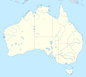
Harvey
Nahimutangan sa Harvey sa Awstralya.
Hapit nalukop sa kaumahan ang palibot sa Harvey.[2] Dunay mga 9 ka tawo kada kilometro kwadrado sa palibot sa Harvey may gamay nga populasyon.[3] Ang klima mediteranyo.[4] Ang kasarangang giiniton 16 °C. Ang kinainitan nga bulan Enero, sa 26 °C, ug ang kinabugnawan Hunyo, sa 8 °C.[5] Ang kasarangang pag-ulan 1,014 milimetro matag tuig. Ang kinabasaan nga bulan Mayo, sa 183 milimetro nga ulan, ug ang kinaugahan Pebrero, sa 9 milimetro.[6]
| ||||||||||||||||||||||||||||||||||||||||||||||||||||||||||||||||||||||||||||||||||||||||||||||||||||||||||||||||||||||||||||
Ang mga gi basihan niini[usba | usba ang wikitext]
↑ 1.01.11.2 Harvey sa GeoNames.Org (cc-by); post updated 2014-07-26; database download sa 2015-06-27
↑ NASA Earth Observations: Land Cover Classification. NASA/MODIS.
↑ NASA Earth Observations: Population Density. NASA/SEDAC.
↑ Peel, M C; Finlayson, B L. "Updated world map of the Köppen-Geiger climate classification". Hydrology and Earth System Sciences 11: 1633-1644. doi:, http://www.hydrol-earth-syst-sci.net/11/1633/2007/hess-11-1633-2007.html. Gikuha sa 30 Enero 2016.
↑ 5.05.1 NASA Earth Observations Data Set Index. NASA.
↑ NASA Earth Observations: Rainfall (1 month - TRMM). NASA/Tropical Rainfall Monitoring Mission.
Mga kategoriya:
- Awstralya paghimo ni bot
- Paghimo ni bot 2016-01
- Geobox usage tracking for region type
- Mga subdibisyon sa State of Western Australia
(window.RLQ=window.RLQ||).push(function(){mw.config.set({"wgPageParseReport":{"limitreport":{"cputime":"1.336","walltime":"1.983","ppvisitednodes":{"value":40776,"limit":1000000},"ppgeneratednodes":{"value":0,"limit":1500000},"postexpandincludesize":{"value":386962,"limit":2097152},"templateargumentsize":{"value":73347,"limit":2097152},"expansiondepth":{"value":23,"limit":40},"expensivefunctioncount":{"value":0,"limit":500},"unstrip-depth":{"value":0,"limit":20},"unstrip-size":{"value":4622,"limit":5000000},"entityaccesscount":{"value":1,"limit":400},"timingprofile":["100.00% 1859.539 1 -total"," 94.37% 1754.826 1 Plantilya:Geobox"," 80.83% 1503.030 2 Plantilya:Coord"," 78.79% 1465.189 2 Plantilya:CountryAbbr"," 76.13% 1415.586 2 Plantilya:CountryAbbr2"," 71.07% 1321.597 1 Plantilya:Geobox2_coor_title"," 44.23% 822.442 629 Plantilya:Flag"," 10.25% 190.678 1 Plantilya:Geobox2_coor"," 8.92% 165.870 629 Plantilya:Country_flag2"," 1.97% 36.688 1 Plantilya:Cite_journal"]},"scribunto":{"limitreport-timeusage":{"value":"0.035","limit":"10.000"},"limitreport-memusage":{"value":1353113,"limit":52428800}},"cachereport":{"origin":"mw1301","timestamp":"20181019121843","ttl":1900800,"transientcontent":false}}});mw.config.set({"wgBackendResponseTime":103,"wgHostname":"mw1321"});});

 Clash Royale CLAN TAG

