Shire of Narrogin
Shire of Narrogin
Jump to navigation
Jump to search
Shire of Narrogin Western Australia | |||||||||||||||
|---|---|---|---|---|---|---|---|---|---|---|---|---|---|---|---|
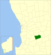 Location in Western Australia | |||||||||||||||
| Population | 884 (2013 est)[1] | ||||||||||||||
| • Density | 0.5461/km2 (1.4143/sq mi) | ||||||||||||||
| Established | 1892 | ||||||||||||||
| Area | 1,618.8 km2 (625.0 sq mi) | ||||||||||||||
| President | Leigh Ballard | ||||||||||||||
| Council seat | Narrogin | ||||||||||||||
| Region | Wheatbelt | ||||||||||||||
| State electorate(s) | Roe | ||||||||||||||
| Federal Division(s) | O'Connor | ||||||||||||||
| Website | Shire of Narrogin | ||||||||||||||
| |||||||||||||||

Shire of Narrogin offices in Narrogin
The Shire of Narrogin is a local government area in the Wheatbelt region of Western Australia, about 190 kilometres (118 mi) south-east of the state capital, Perth. The seat of government is in the town of Narrogin. Until 2016, when the two entities merged, the Narrogin townsite was governed by a separate local government area, the Town of Narrogin.
Contents
1 History
2 Wards
3 Towns and localities
4 Population
5 See also
6 References
7 External links
History[edit]
In 1892, the Narrogin Road District came into being. On 1 July 1961, it became a Shire under the Local Government Act 1960.[2] In 1999 and 2004, proposals to merge the Shire with the Town of Narrogin were defeated at referendum.[3] In 2016, on July 1, the Shire of Narrogin amalgamated with the Town of Narrogin. The new entity retained the designation of Shire.
Wards[edit]
This section needs to be updated. (September 2016) |
The shire had four wards until the 2005 election, but they have since been abolished. Seven councillors now sit at large.
Towns and localities[edit]
- Boundain
- Highbury
- Narrogin
- Nomans Lake
- Yilliminning
Population[edit]
- Note: population figures are for the pre-2016 shire only.
| Year | Population |
|---|---|
| 1911 | 889 |
| 1921 | 1,117 |
| 1933 | 1,217 |
| 1947 | 844 |
| 1954 | 966 |
| 1961 | 972 |
| 1966 | 1,010 |
| 1971 | 905 |
| 1976 | 843 |
| 1981 | 813 |
| 1986 | 680 |
| 1991 | 862 |
| 1996 | 867 |
| 2001 | 843 |
| 2006 | 830 |
See also[edit]
- Narrogin, Western Australia
- Town of Narrogin
References[edit]
^ "3218.0 Regional Population Growth, Australia. Table 5. Estimated Resident Population, Local Government Areas, Western Australia". 3 April 2014. Retrieved 11 September 2014..mw-parser-output cite.citation{font-style:inherit}.mw-parser-output q{quotes:"""""""'""'"}.mw-parser-output code.cs1-code{color:inherit;background:inherit;border:inherit;padding:inherit}.mw-parser-output .cs1-lock-free a{background:url("//upload.wikimedia.org/wikipedia/commons/thumb/6/65/Lock-green.svg/9px-Lock-green.svg.png")no-repeat;background-position:right .1em center}.mw-parser-output .cs1-lock-limited a,.mw-parser-output .cs1-lock-registration a{background:url("//upload.wikimedia.org/wikipedia/commons/thumb/d/d6/Lock-gray-alt-2.svg/9px-Lock-gray-alt-2.svg.png")no-repeat;background-position:right .1em center}.mw-parser-output .cs1-lock-subscription a{background:url("//upload.wikimedia.org/wikipedia/commons/thumb/a/aa/Lock-red-alt-2.svg/9px-Lock-red-alt-2.svg.png")no-repeat;background-position:right .1em center}.mw-parser-output .cs1-subscription,.mw-parser-output .cs1-registration{color:#555}.mw-parser-output .cs1-subscription span,.mw-parser-output .cs1-registration span{border-bottom:1px dotted;cursor:help}.mw-parser-output .cs1-hidden-error{display:none;font-size:100%}.mw-parser-output .cs1-visible-error{font-size:100%}.mw-parser-output .cs1-subscription,.mw-parser-output .cs1-registration,.mw-parser-output .cs1-format{font-size:95%}.mw-parser-output .cs1-kern-left,.mw-parser-output .cs1-kern-wl-left{padding-left:0.2em}.mw-parser-output .cs1-kern-right,.mw-parser-output .cs1-kern-wl-right{padding-right:0.2em}
^ WA Electoral Commission, Municipality Boundary Amendments Register (release 3.0), 31 July 2007.
^ ABC Online (27 February 2004). "Narrogin Shire residents make merger feelings clear". Retrieved 2 November 2006.
External links[edit]
Official website
Coordinates: 32°56′10″S 117°10′41″E / 32.936°S 117.178°E / -32.936; 117.178
Categories:
- Populated places established in 1892
- 1892 establishments in Australia
- Local government areas of the Wheatbelt region of Western Australia
- Shire of Narrogin
(window.RLQ=window.RLQ||).push(function(){mw.config.set({"wgPageParseReport":{"limitreport":{"cputime":"0.320","walltime":"0.416","ppvisitednodes":{"value":1964,"limit":1000000},"ppgeneratednodes":{"value":0,"limit":1500000},"postexpandincludesize":{"value":80465,"limit":2097152},"templateargumentsize":{"value":3031,"limit":2097152},"expansiondepth":{"value":13,"limit":40},"expensivefunctioncount":{"value":4,"limit":500},"unstrip-depth":{"value":1,"limit":20},"unstrip-size":{"value":5905,"limit":5000000},"entityaccesscount":{"value":1,"limit":400},"timingprofile":["100.00% 334.059 1 -total"," 41.98% 140.248 1 Template:Infobox_Australian_place"," 19.78% 66.087 1 Template:Infobox"," 19.78% 66.066 1 Template:Reflist"," 17.49% 58.415 2 Template:Cite_web"," 13.03% 43.520 1 Template:Short_description"," 12.25% 40.919 1 Template:Pagetype"," 10.31% 34.440 1 Template:Outdated_section"," 10.21% 34.120 1 Template:Convert"," 9.43% 31.485 10 Template:Main_other"]},"scribunto":{"limitreport-timeusage":{"value":"0.145","limit":"10.000"},"limitreport-memusage":{"value":5333366,"limit":52428800}},"cachereport":{"origin":"mw1330","timestamp":"20181013184050","ttl":1900800,"transientcontent":false}}});mw.config.set({"wgBackendResponseTime":97,"wgHostname":"mw1267"});});

 Clash Royale CLAN TAG

