Shire of Victoria Plains
Shire of Victoria Plains
Jump to navigation
Jump to search
Shire of Victoria Plains Western Australia | |||||||||||||||
|---|---|---|---|---|---|---|---|---|---|---|---|---|---|---|---|
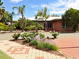 Victoria Plains shire offices, Calingiri, 2014 | |||||||||||||||
 Location in Western Australia | |||||||||||||||
| Population | 921 (2013 est)[1] | ||||||||||||||
| • Density | 0.35851/km2 (0.9285/sq mi) | ||||||||||||||
| Established | 1871 | ||||||||||||||
| Area | 2,569 km2 (991.9 sq mi) | ||||||||||||||
| Mayor | Geoff Erickson | ||||||||||||||
| Council seat | Calingiri | ||||||||||||||
| Region | Wheatbelt | ||||||||||||||
| State electorate(s) | Moore | ||||||||||||||
| Federal Division(s) | Durack | ||||||||||||||
 | |||||||||||||||
| Website | Shire of Victoria Plains | ||||||||||||||
| |||||||||||||||
The Shire of Victoria Plains is a local government area in the Wheatbelt region of Western Australia, about 160 kilometres (100 mi) north of the state capital, Perth. It covers an area of 2,569 square kilometres (992 sq mi), and its seat of government is the town of Calingiri.
Contents
1 History
2 Wards
3 Towns and localities
4 Presidents
5 Population
6 References
7 External links
History[edit]
In 1871, the Victoria Plains Road District was created over an area extending as far north as Carnamah and east to the South Australian border. These areas gradually obtained their own local government over the next 40 years. On 1 July 1961, the area that remained became the Shire of Victoria Plains under the Local Government Act 1960.[2]
Wards[edit]
The shire is divided into four wards.
- West Ward (three councillors)
- Central Ward (two councillors)
- East Ward (two councillors)
- South Ward (two councillors)
Towns and localities[edit]
- Bolgart
- Calingiri
- Gillingarra
- Mogumber
- New Norcia
- Piawaning
- Waddington
- Yerecoin
Presidents[edit]
Population[edit]
| Year | Population |
|---|---|
| 1911 | 880 |
| 1921 | 1,089 |
| 1933 | 1,241 |
| 1947 | 1,124 |
| 1954 | 1,810 |
| 1961 | 2,030 |
| 1966 | 1,785 |
| 1971 | 1,700 |
| 1976 | 1,493 |
| 1981 | 1,332 |
| 1986 | 1,243 |
| 1991 | 1,079 |
| 1996 | 943 |
| 2001 | 963 |
| 2006 | 903 |
| 2011 | 895 |
References[edit]
^ "3218.0 Regional Population Growth, Australia. Table 5. Estimated Resident Population, Local Government Areas, Western Australia". 3 April 2014. Retrieved 11 September 2014..mw-parser-output cite.citation{font-style:inherit}.mw-parser-output q{quotes:"""""""'""'"}.mw-parser-output code.cs1-code{color:inherit;background:inherit;border:inherit;padding:inherit}.mw-parser-output .cs1-lock-free a{background:url("//upload.wikimedia.org/wikipedia/commons/thumb/6/65/Lock-green.svg/9px-Lock-green.svg.png")no-repeat;background-position:right .1em center}.mw-parser-output .cs1-lock-limited a,.mw-parser-output .cs1-lock-registration a{background:url("//upload.wikimedia.org/wikipedia/commons/thumb/d/d6/Lock-gray-alt-2.svg/9px-Lock-gray-alt-2.svg.png")no-repeat;background-position:right .1em center}.mw-parser-output .cs1-lock-subscription a{background:url("//upload.wikimedia.org/wikipedia/commons/thumb/a/aa/Lock-red-alt-2.svg/9px-Lock-red-alt-2.svg.png")no-repeat;background-position:right .1em center}.mw-parser-output .cs1-subscription,.mw-parser-output .cs1-registration{color:#555}.mw-parser-output .cs1-subscription span,.mw-parser-output .cs1-registration span{border-bottom:1px dotted;cursor:help}.mw-parser-output .cs1-hidden-error{display:none;font-size:100%}.mw-parser-output .cs1-visible-error{font-size:100%}.mw-parser-output .cs1-subscription,.mw-parser-output .cs1-registration,.mw-parser-output .cs1-format{font-size:95%}.mw-parser-output .cs1-kern-left,.mw-parser-output .cs1-kern-wl-left{padding-left:0.2em}.mw-parser-output .cs1-kern-right,.mw-parser-output .cs1-kern-wl-right{padding-right:0.2em}
^ WA Electoral Commission, Municipality Boundary Amendments Register (release 3.0), 31 July 2007.
External links[edit]
![]() Media related to Shire of Victoria Plains at Wikimedia Commons
Media related to Shire of Victoria Plains at Wikimedia Commons
Official website
Coordinates: 31°05′17″S 116°27′11″E / 31.088°S 116.453°E / -31.088; 116.453
Categories:
- Populated places established in 1871
- 1871 establishments in Australia
- Local government areas of the Wheatbelt region of Western Australia
- Shire of Victoria Plains
(window.RLQ=window.RLQ||).push(function(){mw.config.set({"wgPageParseReport":{"limitreport":{"cputime":"0.316","walltime":"0.418","ppvisitednodes":{"value":1916,"limit":1000000},"ppgeneratednodes":{"value":0,"limit":1500000},"postexpandincludesize":{"value":76264,"limit":2097152},"templateargumentsize":{"value":2664,"limit":2097152},"expansiondepth":{"value":12,"limit":40},"expensivefunctioncount":{"value":3,"limit":500},"unstrip-depth":{"value":1,"limit":20},"unstrip-size":{"value":3305,"limit":5000000},"entityaccesscount":{"value":1,"limit":400},"timingprofile":["100.00% 316.572 1 -total"," 38.14% 120.753 1 Template:Infobox_Australian_place"," 20.31% 64.296 1 Template:Infobox"," 18.74% 59.337 1 Template:Reflist"," 16.88% 53.426 1 Template:Cite_web"," 15.35% 48.594 1 Template:Commonscat-inline"," 14.13% 44.728 1 Template:Sister-inline"," 10.82% 34.250 2 Template:Convert"," 9.91% 31.374 1 Template:Short_description"," 9.41% 29.776 2 Template:Navbox"]},"scribunto":{"limitreport-timeusage":{"value":"0.116","limit":"10.000"},"limitreport-memusage":{"value":4751835,"limit":52428800}},"cachereport":{"origin":"mw1268","timestamp":"20181013212430","ttl":1900800,"transientcontent":false}}});mw.config.set({"wgBackendResponseTime":104,"wgHostname":"mw1262"});});

 Clash Royale CLAN TAG

