National Register of Historic Places listings in Lowell, Massachusetts
National Register of Historic Places listings in Lowell, Massachusetts
Jump to navigation
Jump to search
These are the National Registered Historic Places listings in Lowell, Massachusetts.
This National Park Service list is complete through NPS recent listings posted October 4, 2018.[1]
Current listings[edit]
| [2] | Name on the Register[3] | Image | Date listed[4] | Location | City or town | Description |
|---|---|---|---|---|---|---|
1 | Allen House | 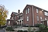 | August 11, 1982 (#82001992) | 2 Solomont Way 42°38′33″N 71°20′12″W / 42.6425°N 71.336667°W / 42.6425; -71.336667 (Allen House) | Listed at 57 Rolfe Street, now on the campus of University of Massachusetts Lowell. | |
2 | Andover Street Historic District |  | June 2, 2000 (#00000568) | 245–834 Andover St., 569, 579 E. Merrimack St. 42°38′37″N 71°17′11″W / 42.643611°N 71.286389°W / 42.643611; -71.286389 (Andover Street Historic District) | ||
3 | Belvidere Hill Historic District |  | May 26, 1995 (#95000656) | Fairview, Talbot and Summit Sts. and parts of Nesmith, Mansur and Fairmount Sts. and Belmont Ave. 42°38′17″N 71°17′34″W / 42.638056°N 71.292778°W / 42.638056; -71.292778 (Belvidere Hill Historic District) | ||
4 | Jerathmell Bowers House | 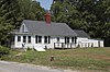 | January 28, 1994 (#93001588) | 150 Wood St. 42°37′50″N 71°21′19″W / 42.630556°N 71.355278°W / 42.630556; -71.355278 (Jerathmell Bowers House) | ||
5 | Jonathan Bowers House |  | June 18, 1976 (#76000253) | 58 Wannalancit St. 42°38′46″N 71°19′42″W / 42.646111°N 71.328333°W / 42.646111; -71.328333 (Jonathan Bowers House) | ||
6 | Brown-Maynard House |  | July 2, 1986 (#86001460) | 84 Tenth St. 42°39′16″N 71°17′58″W / 42.654444°N 71.299444°W / 42.654444; -71.299444 (Brown-Maynard House) | ||
7 | Butler School | 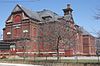 | February 2, 1995 (#94001634) | 812 Gorham St. 42°37′50″N 71°18′30″W / 42.630556°N 71.308333°W / 42.630556; -71.308333 (Butler School) | ||
8 | Chelmsford Glass Works' Long House | 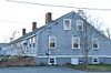 | January 25, 1973 (#73000302) | 139–141 Baldwin St. 42°38′02″N 71°20′57″W / 42.633943°N 71.34921°W / 42.633943; -71.34921 (Chelmsford Glass Works' Long House) | ||
9 | City Hall Historic District | 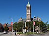 | April 21, 1975 (#75000156) | Roughly area between Broadway and French Sts., Colburn St. and both sides of Kirk St. 42°38′46″N 71°18′48″W / 42.646111°N 71.313333°W / 42.646111; -71.313333 (City Hall Historic District) | Boundary increase (added 1988-10-13): 165 Market St. | |
10 | Colburn School |  | May 19, 1995 (#94001592) | 136 Lawrence St. 42°38′23″N 71°18′16″W / 42.639722°N 71.304444°W / 42.639722; -71.304444 (Colburn School) | ||
11 | Flagg-Coburn House |  | May 15, 1986 (#86001052) | 722 E. Merrimack St. 42°38′45″N 71°17′14″W / 42.645833°N 71.287222°W / 42.645833; -71.287222 (Flagg-Coburn House) | ||
12 | Warren Fox Building | 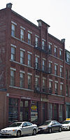 | October 12, 1989 (#89001609) | 190–196 Middlesex St. 42°38′26″N 71°18′45″W / 42.640556°N 71.3125°W / 42.640556; -71.3125 (Warren Fox Building) | ||
13 | Grace Universalist Church | 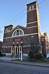 | March 11, 2011 (#11000069) | 44 Princeton Boulevard 42°38′07″N 71°19′58″W / 42.635278°N 71.332778°W / 42.635278; -71.332778 (Grace Universalist Church) | Now known as the St. George Hellenic Orthodox Church | |
14 | Holy Trinity Greek Orthodox Church | 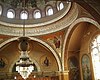 | April 13, 1977 (#77000181) | 62 Lewis St. 42°38′44″N 71°19′02″W / 42.645556°N 71.317222°W / 42.645556; -71.317222 (Holy Trinity Greek Orthodox Church) | ||
15 | Howe Building |  | October 12, 1989 (#89001608) | 208 Middlesex St. 42°38′26″N 71°18′46″W / 42.640556°N 71.312778°W / 42.640556; -71.312778 (Howe Building) | ||
16 | Hoyt-Shedd Estate | 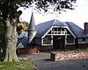 | May 17, 1984 (#84002697) | 386–396 Andover St., 569–579 E. Merrimack St. 42°38′35″N 71°17′28″W / 42.643056°N 71.291111°W / 42.643056; -71.291111 (Hoyt-Shedd Estate) | ||
17 | Lowell Cemetery | 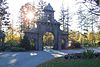 | May 20, 1998 (#98000543) | 984 Lawrence St. 42°37′40″N 71°17′42″W / 42.627778°N 71.295°W / 42.627778; -71.295 (Lowell Cemetery) | ||
18 | Lowell Historic Preservation District |  | January 19, 2001 (#03000170) | Lowell area around Merrimack River 42°38′48″N 71°18′29″W / 42.6468°N 71.3081°W / 42.6468; -71.3081 (Lowell Historic Preservation District) | ||
19 | Lowell Locks and Canals Historic District | 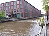 | August 13, 1976 (#76001972) | Between Middlesex St. and the Merrimack River 42°38′44″N 71°19′12″W / 42.645556°N 71.32°W / 42.645556; -71.32 (Lowell Locks and Canals Historic District) | National Historic Landmark | |
20 | Lowell National Historical Park |  | June 5, 1978 (#78003149) | Merrimack St. 42°38′47″N 71°19′11″W / 42.646389°N 71.319722°W / 42.646389; -71.319722 (Lowell National Historical Park) | ||
21 | Lowell Post Office | 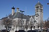 | October 4, 2002 (#02001084) | 89 Appleton St. 42°38′28″N 71°18′34″W / 42.641111°N 71.309444°W / 42.641111; -71.309444 (Lowell Post Office) | ||
22 | Middlesex Canal |  | August 21, 1972 (#72000117) | Running SE between towns of Lowell and Woburn 42°38′16″N 71°21′02″W / 42.637842°N 71.350586°W / 42.637842; -71.350586 (Middlesex Canal) | ||
23 | Middlesex Canal Historic and Archaeological District |  | November 19, 2009 (#09000936) | Numerous locations along the historic route of the Middlesex Canal 42°38′48″N 71°18′29″W / 42.6468°N 71.3081°W / 42.6468; -71.3081 (Middlesex Canal Historic and Archaeological District) | Extends into Suffolk County and other parts of Middlesex County; encompasses Middlesex Canal and other listings. | |
24 | Monarch Diner |  | November 28, 2003 (#03001207) | 246 Appleton St. 42°38′21″N 71°18′50″W / 42.639167°N 71.313889°W / 42.639167; -71.313889 (Monarch Diner) | Now operating as The Owl Diner. | |
25 | Musketaquid Mills |  | December 9, 1999 (#99001480) | 131 Davidson St. 42°38′37″N 71°18′16″W / 42.643611°N 71.304444°W / 42.643611; -71.304444 (Musketaquid Mills) | ||
26 | Pawtucket Congregational Church |  | March 21, 2007 (#07000167) | 15 Mammoth Rd. 42°39′02″N 71°19′56″W / 42.650556°N 71.332222°W / 42.650556; -71.332222 (Pawtucket Congregational Church) | ||
27 | Rogers Fort Hill Park Historic District |  | May 27, 1999 (#99000635) | Roughly bounded by High St., Mansur St., Concord R., and Lowell Cemetery 42°38′06″N 71°17′47″W / 42.635°N 71.296389°W / 42.635; -71.296389 (Rogers Fort Hill Park Historic District) | ||
28 | St. George Antiochian Orthodox Church |  | June 10, 2008 (#08000507) | 61 Bowers St. 42°38′53″N 71°19′26″W / 42.647919°N 71.323992°W / 42.647919; -71.323992 (St. George Antiochian Orthodox Church) | ||
29 | St. Joseph's Convent and School |  | July 19, 2002 (#02000789) | 517 Moody St. 42°39′02″N 71°19′20″W / 42.650556°N 71.322222°W / 42.650556; -71.322222 (St. Joseph's Convent and School) | ||
30 | Saint Joseph's Roman Catholic College for Boys |  | February 24, 2010 (#10000041) | 760 Merrimack St. 42°38′56″N 71°19′14″W / 42.648953°N 71.320417°W / 42.648953; -71.320417 (Saint Joseph's Roman Catholic College for Boys) | ||
31 | St. Patrick's Church |  | January 3, 1985 (#85000027) | 284 Suffolk St. 42°38′43″N 71°19′03″W / 42.645292°N 71.317517°W / 42.645292; -71.317517 (St. Patrick's Church) | ||
32 | South Common Historic District |  | August 10, 1982 (#82001993) | Roughly bounded by Summer, Gorham, Horndike, and Highland Sts. 42°38′13″N 71°18′41″W / 42.636944°N 71.311389°W / 42.636944; -71.311389 (South Common Historic District) | ||
33 | Tyler Park Historic District |  | August 17, 1989 (#89001056) | Roughly bounded by Princeton, Foster, and Pine Sts. 42°37′52″N 71°20′27″W / 42.631111°N 71.340833°W / 42.631111; -71.340833 (Tyler Park Historic District) | ||
34 | US Post Office |  | March 10, 1986 (#86000373) | 50 Kearny Sq. 42°38′43″N 71°18′24″W / 42.645278°N 71.306667°W / 42.645278; -71.306667 (US Post Office) | Renamed the F. Bradford Morse Federal Building in 2006.[5] | |
35 | Varnum Building |  | December 19, 1988 (#88002752) | 401–405 Bridge St. 42°39′01″N 71°18′14″W / 42.650278°N 71.303889°W / 42.650278; -71.303889 (Varnum Building) | Demolished after fire | |
36 | Varnum School |  | January 24, 1995 (#94001591) | 103 Sixth St. 42°39′04″N 71°17′58″W / 42.651111°N 71.299444°W / 42.651111; -71.299444 (Varnum School) | ||
37 | Wamesit Canal-Whipple Mill Industrial Complex |  | August 11, 1982 (#82001994) | 576 Lawrence St. 42°37′57″N 71°18′03″W / 42.6325°N 71.300833°W / 42.6325; -71.300833 (Wamesit Canal-Whipple Mill Industrial Complex) | ||
38 | Wannalancit Street Historic District |  | May 20, 1998 (#98000541) | 14–71 Wannalancit St., and 390, 406 Pawtucket St. 42°38′48″N 71°19′46″W / 42.646667°N 71.329444°W / 42.646667; -71.329444 (Wannalancit Street Historic District) | ||
39 | Washington Square Historic District |  | August 11, 1982 (#82001995) | Roughly bounded by Merrimack, Park, Andover, Oak, Harrison, and Willow Sts. 42°38′35″N 71°17′54″W / 42.643056°N 71.298333°W / 42.643056; -71.298333 (Washington Square Historic District) | Boundary increase (added 1999-11-12): 140-160 Andover St. | |
40 | Wilder Street Historic District |  | May 26, 1995 (#95000662) | 284–360 Wilder St. 42°38′11″N 71°19′56″W / 42.636389°N 71.332222°W / 42.636389; -71.332222 (Wilder Street Historic District) | ||
41 | Worcester House |  | December 22, 1983 (#83004091) | 658 Andover St. 42°38′42″N 71°16′50″W / 42.645°N 71.280556°W / 42.645; -71.280556 (Worcester House) |
References[edit]
| Wikimedia Commons has media related to National Register of Historic Places in Lowell, Massachusetts. |
^ https://www.nps.gov/subjects/nationalregister/weekly-list.htm "National Register of Historic Places: Weekly List Actions"]. National Park Service, United States Department of the Interior. Retrieved on October 4, 2018.
^ Numbers represent an ordering by significant words. Various colorings, defined here, differentiate National Historic Landmarks and historic districts from other NRHP buildings, structures, sites or objects.
^ National Park Service (2008-04-24). "National Register Information System". National Register of Historic Places. National Park Service..mw-parser-output cite.citation{font-style:inherit}.mw-parser-output q{quotes:"""""""'""'"}.mw-parser-output code.cs1-code{color:inherit;background:inherit;border:inherit;padding:inherit}.mw-parser-output .cs1-lock-free a{background:url("//upload.wikimedia.org/wikipedia/commons/thumb/6/65/Lock-green.svg/9px-Lock-green.svg.png")no-repeat;background-position:right .1em center}.mw-parser-output .cs1-lock-limited a,.mw-parser-output .cs1-lock-registration a{background:url("//upload.wikimedia.org/wikipedia/commons/thumb/d/d6/Lock-gray-alt-2.svg/9px-Lock-gray-alt-2.svg.png")no-repeat;background-position:right .1em center}.mw-parser-output .cs1-lock-subscription a{background:url("//upload.wikimedia.org/wikipedia/commons/thumb/a/aa/Lock-red-alt-2.svg/9px-Lock-red-alt-2.svg.png")no-repeat;background-position:right .1em center}.mw-parser-output .cs1-subscription,.mw-parser-output .cs1-registration{color:#555}.mw-parser-output .cs1-subscription span,.mw-parser-output .cs1-registration span{border-bottom:1px dotted;cursor:help}.mw-parser-output .cs1-hidden-error{display:none;font-size:100%}.mw-parser-output .cs1-visible-error{font-size:100%}.mw-parser-output .cs1-subscription,.mw-parser-output .cs1-registration,.mw-parser-output .cs1-format{font-size:95%}.mw-parser-output .cs1-kern-left,.mw-parser-output .cs1-kern-wl-left{padding-left:0.2em}.mw-parser-output .cs1-kern-right,.mw-parser-output .cs1-kern-wl-right{padding-right:0.2em}
^ The eight-digit number below each date is the number assigned to each location in the National Register Information System database, which can be viewed by clicking the number.
^ Mayer-Hahdahl, Alexandra (2006-12-09). "A statement to a statesman". Lowell Sun.State, city and education officials took a step toward reviving Morse's memory yesterday afternoon, when they dedicated Middlesex Community College's Federal Building in honor of the late U.S. representative, diplomat and United Nation's official. ... The dedication of the F. Bradford Morse Federal Building is one in a slew of efforts to memorialize Morse.
U.S. National Register of Historic Places in Massachusetts | |||||||||||||||||
|---|---|---|---|---|---|---|---|---|---|---|---|---|---|---|---|---|---|
| Topics |
|  | |||||||||||||||
| Lists by county |
| ||||||||||||||||
| Lists by city |
| ||||||||||||||||
| Other lists |
| ||||||||||||||||
| |||||||||||||||||
Categories:
- Buildings and structures in Lowell, Massachusetts
- Lists of National Register of Historic Places in Massachusetts by populated place
- National Register of Historic Places in Lowell, Massachusetts
- Lists of National Register of Historic Places by city
(window.RLQ=window.RLQ||).push(function(){mw.config.set({"wgPageParseReport":{"limitreport":{"cputime":"0.704","walltime":"0.855","ppvisitednodes":{"value":16351,"limit":1000000},"ppgeneratednodes":{"value":0,"limit":1500000},"postexpandincludesize":{"value":277053,"limit":2097152},"templateargumentsize":{"value":20121,"limit":2097152},"expansiondepth":{"value":11,"limit":40},"expensivefunctioncount":{"value":0,"limit":500},"unstrip-depth":{"value":1,"limit":20},"unstrip-size":{"value":7134,"limit":5000000},"entityaccesscount":{"value":1,"limit":400},"timingprofile":["100.00% 494.383 1 -total"," 62.71% 310.018 41 Template:NRHP_row"," 15.88% 78.513 1 Template:NRHP_header"," 15.08% 74.564 82 Template:First_word"," 13.31% 65.812 41 Template:Coord"," 13.06% 64.553 41 Template:Designation/color"," 12.27% 60.650 1 Template:NRISref"," 11.74% 58.056 1 Template:Cite_web"," 10.28% 50.803 34 Template:NRHP_color"," 10.04% 49.639 41 Template:Dts"]},"scribunto":{"limitreport-timeusage":{"value":"0.202","limit":"10.000"},"limitreport-memusage":{"value":3857723,"limit":52428800}},"cachereport":{"origin":"mw1327","timestamp":"20181013204013","ttl":1900800,"transientcontent":false}}});mw.config.set({"wgBackendResponseTime":83,"wgHostname":"mw1256"});});

 Clash Royale CLAN TAG

