List of National Historic Landmarks in Boston
List of National Historic Landmarks in Boston
Jump to navigation
Jump to search
This is a list of National Historic Landmarks in Boston, Massachusetts. It includes 57 properties and districts designated as National Historic Landmarks in the city of Boston, Massachusetts, United States. Another 131 National Historic Landmarks are located in the remaining parts of the state of Massachusetts.[1]
Contents
1 Current National Historic Landmarks
2 Historic areas of the NPS in Boston
3 See also
4 References
5 External links
Current National Historic Landmarks[edit]
The National Historic Landmarks in Boston are spread out over many neighborhoods, from the waterfront to Jamaica Plain.
| [2] | Landmark name | Image | Date designated[3] | Location | Description |
|---|---|---|---|---|---|
1 | African Meeting House | 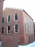 | May 30, 1974 (#71000087) | 8 Smith Ct Beacon Hill 42°21′36″N 71°03′56″W / 42.3599°N 71.0655°W / 42.3599; -71.0655 (African Meeting House) | Also known as the First African Baptist Church, it was built in 1806 and is now the oldest black church edifice still standing in the United States. |
2 | Nathan Appleton Residence |  | December 22, 1977 (#77001541) | 39–40 Beacon Street Beacon Hill 42°21′25″N 71°03′59″W / 42.3569°N 71.0663°W / 42.3569; -71.0663 (Nathan Appleton Residence) | Residence of Nathan Appleton, a businessman involved in expanding the textile industry. His son-in-law was Henry Wadsworth Longfellow, who married Appleton's daughter Fanny in this house. |
3 | Arnold Arboretum |  | January 12, 1965 (#66000127) | Jamaica Plain 42°17′52″N 71°07′22″W / 42.2978°N 71.1228°W / 42.2978; -71.1228 (Arnold Arboretum) | Harvard University-owned arboretum, founded in 1872 and designed by Frederick Law Olmsted. |
4 | Frederick Ayer Mansion |  | April 5, 2005 (#05000459) | 395 Commonwealth Ave. Back Bay 42°20′57″N 71°05′25″W / 42.3493°N 71.0903°W / 42.3493; -71.0903 (Frederick Ayer Mansion) | The home of textile businessman Frederick Ayer, its interior is one of few designed by Louis Comfort Tiffany, and its exterior has the only surviving instance of an outside mosaic by Tiffany. |
5 | Beacon Hill Historic District | December 29, 1962 (#66000130) | Beacon Hill 42°21′30″N 71°03′58″W / 42.3583°N 71.0661°W / 42.3583; -71.0661 (Beacon Hill Historic District) | This architecturally significant neighborhood includes buildings designed by Charles Bulfinch, and has been home to many famous people, including nationally prominent politicians, businessmen, and academics. | |
6 | Boston Athenaeum |  | December 21, 1965 (#66000132) | 10 1/2 Beacon Street Beacon Hill 42°21′30″N 71°03′43″W / 42.3582°N 71.0620°W / 42.3582; -71.0620 (Boston Athenaeum) | Home of one of the nation's oldest and largest independent private libraries, this building was designed by Edward Clarke Cabot. |
7 | Boston Common |  | February 27, 1987 (#87000760) | Beacon Hill 42°21′18″N 71°03′56″W / 42.355°N 71.0656°W / 42.355; -71.0656 (Boston Common) | Established in 1634, the Common is the nation's oldest public park. |
8 | Boston Light |  | January 29, 1964 (#66000133) | Little Brewster Island Boston Harbor 42°19′40″N 70°53′24″W / 42.3279°N 70.8900°W / 42.3279; -70.8900 (Boston Light) | The nation's second oldest standing lighthouse, Boston Light was built on the site of the first lighthouse in what is now the United States. It is the only lighthouse permanently staffed by the United States Coast Guard. |
9 | Boston Naval Shipyard |  | November 13, 1966 (#66000134) | Charlestown 42°22′26″N 71°03′23″W / 42.3738°N 71.0565°W / 42.3738; -71.0565 (Boston Naval Shipyard) | One the nation's oldest shipyards, this shipyard is home to two NHL ships (USS Constitution and USS Cassin Young), and has the only surviving ropewalk that has not been moved or significantly altered. |
10 | Boston Public Gardens |  | February 27, 1987 (#87000761) | Back Bay 42°21′15″N 71°04′12″W / 42.3541°N 71.0699°W / 42.3541; -71.0699 (Boston Public Gardens) | The nation's first public botanical garden, it was laid out in the French Second Empire style in the 1860s. |
11 | Boston Public Library |  | February 24, 1986 (#73000317) | 230 Dartmouth Street Back Bay 42°20′59″N 71°04′39″W / 42.3496°N 71.0776°W / 42.3496; -71.0776 (Boston Public Library) | Built in the 1880s to a design by Charles Follen McKim inspired by similar European institutions, this building features murals by John Singer Sargent and Bates Hall, its large and light-filled reading room. |
12 | Brook Farm |  | July 23, 1965 (#66000141) | 670 Baker Street West Roxbury 42°17′29″N 71°10′27″W / 42.2914°N 71.1741°W / 42.2914; -71.1741 (Brook Farm) | Site of an experimental utopian community based on Transcendentalist and Unitarian thought. |
13 | Bunker Hill Monument |  | January 20, 1961 (#66000138) | Charlestown 42°22′35″N 71°03′39″W / 42.3763°N 71.0608°W / 42.3763; -71.0608 (Bunker Hill Monument) | This monument, built in the mid-19th century, stands atop Breed's Hill, site of most of the fighting in the 1775 Battle of Bunker Hill. |
14 | USS Cassin Young (destroyer) |  | January 14, 1986 (#86000084) | Boston Navy Yard Charlestown 42°22′20″N 71°03′16″W / 42.3722°N 71.0545°W / 42.3722; -71.0545 (USS Cassin Young (destroyer)) | A Fletcher-class destroyer, USS Cassin Young was a ship of the United States Navy. Launched during the Second World War, she saw action in the Battle of Leyte and the Battle of Okinawa. She received seven battle stars and a Navy Unit Commendation for her war service. |
15 | Central Congregational Church |  | October 16, 2012 (#12001012) | 67 Newbury Street Back Bay 42°21′08″N 71°04′27″W / 42.3521°N 71.0741°W / 42.3521; -71.0741 (Central Congregational Church) | This church has the largest intact Tiffany-designed ecclesiastical interior in its original location in America. |
16 | USS Constitution (frigate) |  | December 19, 1960 (#66000789) | Boston Navy Yard Charlestown 42°22′20″N 71°03′20″W / 42.3721°N 71.0556°W / 42.3721; -71.0556 (USS Constitution (frigate)) | The world's oldest floating commissioned naval vessel. Launched in 1797, she saw action in the Quasi-War and the War of 1812. She later became a training ship, and presently serves as a museum ship. She last sailed under her own power in August, 2012, to commemorate the 200th anniversary of her victory over Guerriere. |
17 | Ether Dome, Massachusetts General Hospital |  | January 12, 1965 (#66000366) | 55 Fruit Street West End 42°21′49″N 71°04′04″W / 42.3635°N 71.0679°W / 42.3635; -71.0679 (Ether Dome, Massachusetts General Hospital) | The operating room of the Massachusetts General Hospital from 1821 to 1867, the Ether Dome was the site of the first public demonstration of the use of ether as an anesthetic. |
18 | Faneuil Hall |  | October 9, 1960 (#66000368) | Downtown 42°21′36″N 71°03′23″W / 42.3601°N 71.0563°W / 42.3601; -71.0563 (Faneuil Hall) | Built on the site of a building originally donated by Huguenot merchant Peter Faneuil to the city of Boston, this iconic market building and meeting house was built in the 1760s and expanded in the 19th century by architect Charles Bulfinch. It was the site of many public meetings during the American Revolution. |
19 | Fenway Studios |  | August 5, 1998 (#78000473) | Fenway–Kenmore 42°20′51″N 71°05′23″W / 42.3475°N 71.0898°W / 42.3475; -71.0898 (Fenway Studios) | This building was purpose-built as studios for artists in 1904–1905 in the Arts and Crafts style. |
20 | First Harrison Gray Otis House |  | December 30, 1970 (#70000539) | 141 Cambridge St. West End 42°21′40″N 71°03′53″W / 42.3612°N 71.0646°W / 42.3612; -71.0646 (First Harrison Gray Otis House) | Home built for Federalist Party leader Harrison Gray Otis, designed by architect Charles Bulfinch. |
21 | Fort Warren |  | May 22, 1970 (#70000540) | Georges Island 42°19′13″N 70°55′39″W / 42.3202°N 70.9276°W / 42.3202; -70.9276 (Fort Warren) | A 19th-century fortification built in Boston Harbor, Fort Warren saw service through the First World War. It is named for Dr. Joseph Warren, a Revolutionary War political leader who was killed in the Battle of Bunker Hill. |
22 | William Lloyd Garrison House |  | June 23, 1965 (#66000653) | 125 Highland St. Roxbury 42°19′33″N 71°05′36″W / 42.3258°N 71.0932°W / 42.3258; -71.0932 (William Lloyd Garrison House) | Home of abolitionist leader William Lloyd Garrison, publisher of the anti-slavery newspaper The Liberator. |
23 | Gibson House |  | August 7, 2001 (#01001048) | 137 Beacon Street Back Bay 42°21′18″N 71°04′28″W / 42.3549°N 71.0745°W / 42.3549; -71.0745 (Gibson House) | This Victorian rowhouse is believed to be the only one of its type to preserve both internal and external architectural design elements. Designed by architect Edward Clarke Cabot, the house remained in one family until being opened as a house museum in 1957. |
24 | Chester Harding House |  | December 21, 1965 (#66000764) | 16 Beacon Street Beacon Hill 42°21′29″N 71°03′45″W / 42.358°N 71.0625°W / 42.358; -71.0625 (Chester Harding House) | Federal style home of portrait artist Chester Harding. |
25 | Harvard Stadium |  | February 27, 1987 (#87000757) | 95 North Harvard St. Allston 42°21′59″N 71°07′38″W / 42.3664°N 71.1272°W / 42.3664; -71.1272 (Harvard Stadium) | Built in 1903, this stadium was the prototype for numerous other stadia, and was at the time the largest structure constructed from reinforced concrete. |
26 | Samuel Gridley and Julia Ward Howe House |  | May 30, 1974 (#74002044) | 13 Chestnut Street Beacon Hill 42°21′28″N 71°04′00″W / 42.3577°N 71.0668°W / 42.3577; -71.0668 (Samuel Gridley and Julia Ward Howe House) | Home of noted abolitionists Julia Ward Howe and Samuel Gridley Howe, designed by Charles Bulfinch. |
27 | King's Chapel |  | October 9, 1960 (#74002045) | Corner of Tremont and School Street Downtown 42°21′29″N 71°03′37″W / 42.3580°N 71.0604°W / 42.3580; -71.0604 (King's Chapel) | Now home to a Unitarian Universalist congregation, King's Chapel was built on the site of the first Anglican church in Boston. |
28 | Lightship No. 112, "Nantucket" |  | December 20, 1989 (#89002464) | East Boston 42°21′40″N 71°02′07″W / 42.3612°N 71.0353°W / 42.3612; -71.0353 (Lightship No. 112, "Nantucket") | The largest lightship ever built, and the last active lightship at the time of its nomination. |
29 | Long Wharf and Custom House Block |  | November 13, 1966 (#66000768) | Foot of State Street Boston 42°21′37″N 71°02′55″W / 42.3603°N 71.0487°W / 42.3603; -71.0487 (Long Wharf and Custom House Block) | This wharf was constructed in the early 18th century, and was for many years one of the busiest commercial wharves in Great Britain's North American colonies. The wharf has been much shortened by land reclamation, and is now home to a hotel and other businesses. |
30 | Massachusetts General Hospital |  | December 30, 1970 (#70000682) | 55 Fruit Street West End 42°21′49″N 71°04′03″W / 42.3635°N 71.0676°W / 42.3635; -71.0676 (Massachusetts General Hospital) | The original building for the Massachusetts General Hospital, one of the nation's earliest public hospitals, was designed by Charles Bulfinch. It is the location of the Ether Dome, also a National Historic Landmark. |
31 | Massachusetts Historical Society Building |  | December 21, 1965 (#66000770) | 1154 Boylston St. Fenway–Kenmore 42°20′48″N 71°05′24″W / 42.3467°N 71.0900°W / 42.3467; -71.0900 (Massachusetts Historical Society Building) | This building (built 1899) is home to the Massachusetts Historical Society, the oldest (founded 1791) historic society in the nation. |
32 | Massachusetts Statehouse |  | December 19, 1960 (#66000771) | Beacon Hill 42°21′30″N 71°03′50″W / 42.3584°N 71.064°W / 42.3584; -71.064 (Massachusetts Statehouse) | The state's capitol building, it was built in the 1790s to a design by Charles Bulfinch, with major additions executed in the 1890s to designs by Charles Brigham. The dome was originally sheathed by copper rolled by Paul Revere, but is now covered in gold leaf. |
33 | William C. Nell Residence |  | May 11, 1976 (#76001979) | 3 Smith Ct Beacon Hill 42°21′36″N 71°03′55″W / 42.3601°N 71.0654°W / 42.3601; -71.0654 (William C. Nell Residence) | Home of abolitionist and education advocate William Cooper Nell. |
34 | New England Conservatory of Music |  | April 19, 1994 (#80000672) | 30 Gainsborough Street Fenway–Kenmore 42°20′29″N 71°05′12″W / 42.3413°N 71.0867°W / 42.3413; -71.0867 (New England Conservatory of Music) | The conservatory's 1903 building houses Jordan Hall, a performance space noted for its excellent acoustics. |
35 | New England Hospital for Women and Children |  | July 17, 1991 (#85000317) | 41 and 55 Dimock St. Roxbury 42°19′11″N 71°05′51″W / 42.3197°N 71.0976°W / 42.3197; -71.0976 (New England Hospital for Women and Children) | Designed by Charles Amos Cummings and Willard T. Sears and opened in 1872, this facility was the first public hospital run by women doctors in New England. The organization is now known as the Dimock Center. |
36 | Old City Hall (Boston) |  | December 30, 1970 (#70000687) | 45 School St. Downtown 42°21′29″N 71°03′33″W / 42.3580°N 71.0593°W / 42.3580; -71.0593 (Old City Hall (Boston)) | This building was one of the first in the nation to be designed in the Second Empire style, and served as a prototype for other such buildings, including the Old Executive Office Building in Washington, DC. Designed by Gridley James Fox Bryant and Arthur Gilman, it served as city hall from 1865 to 1969. |
37 | Old North Church |  | January 20, 1961 (#66000776) | 193 Salem St. North End 42°21′59″N 71°03′17″W / 42.3665°N 71.0546°W / 42.3665; -71.0546 (Old North Church) | This church, built in 1723 in a style inspired by English architect Christopher Wren, is the oldest active church building in Boston. It was where Paul Revere ordered lanterns hung ("one if by land, two if by sea, and I on the opposite shore will be") to notify others of British troop movements prior to the Battles of Lexington and Concord. |
38 | Old South Church in Boston |  | December 30, 1970 (#70000690) | 645 Boylston St. Back Bay 42°21′00″N 71°04′40″W / 42.3500°N 71.0777°W / 42.3500; -71.0777 (Old South Church in Boston) | Built in 1873 to designs by Charles Amos Cummings and Willard T. Sears, this church is home to one of the city's oldest congregations (established 1670). |
39 | Old South Meeting House |  | October 9, 1960 (#66000778) | 310 Washington St. Downtown Crossing 42°21′25″N 71°03′31″W / 42.3570°N 71.0587°W / 42.3570; -71.0587 (Old South Meeting House) | An active church as well as a museum, this 1729 building was where the Boston Tea Party was planned on December 16, 1773. It was also the site of other Revolutionary era public gatherings. |
40 | Old State House | 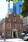 | October 9, 1960 (#66000779) | 206 Washington St. Downtown Crossing 42°21′31″N 71°03′27″W / 42.3587°N 71.0574°W / 42.3587; -71.0574 (Old State House) | This building, constructed 1712, served as the seat of Massachusetts colonial and state government until 1793, when the current state house was built. It was outside this building that the Boston Massacre took place on March 5, 1770. |
41 | Old West Church |  | December 30, 1970 (#70000691) | 131 Cambridge St. West End 42°21′41″N 71°03′51″W / 42.3613°N 71.0642°W / 42.3613; -71.0642 (Old West Church) | This 1837 church (designed by Asher Benjamin) was built on the site of an earlier church whose congregation was noted for its opposition to British rule. Its most famous preacher of the Revolutionary era was Jonathan Mayhew, who may have coined the phrase "no taxation without representation". |
42 | Francis Parkman House |  | December 29, 1962 (#66000782) | 30 Chestnut St. Beacon Hill 42°21′26″N 71°04′07″W / 42.3573°N 71.0686°W / 42.3573; -71.0686 (Francis Parkman House) | Home of noted historian and horticulturalist Francis Parkman. |
43 | Pierce-Hichborn House |  | October 18, 1968 (#68000042) | 29 North Square North End 42°21′49″N 71°03′13″W / 42.3636°N 71.0536°W / 42.3636; -71.0536 (Pierce-Hichborn House) | This house is a rare pre-Georgian brick house, built circa 1711. It is next door to the Paul Revere House, and owned by the Paul Revere Memorial Association. |
44 | William H. Prescott House | December 29, 1964 (#66000765) | 55 Beacon Street Beacon Hill 42°21′24″N 71°04′06″W / 42.3566°N 71.0683°W / 42.3566; -71.0683 (William H. Prescott House) | Also known as Headquarters House, this 1808 house (one half of a duplex rowhouse) was designed by Asher Benjamin and was home of the noted blind historian William H. Prescott. | |
45 | Quincy Market |  | November 13, 1966 (#66000784) | South Market St. Downtown 42°21′37″N 71°03′18″W / 42.3602°N 71.055°W / 42.3602; -71.055 (Quincy Market) | Constructed under the auspices of Boston Mayor Josiah Quincy in the 1820s, the market was designed by architect Alexander Parris and built on land made by filling part of the harbor. The market is a popular tourist site. |
46 | Paul Revere House |  | January 20, 1961 (#66000785) | 19 North Square North End 42°21′50″N 71°03′13″W / 42.3638°N 71.0536°W / 42.3638; -71.0536 (Paul Revere House) | This house is Boston's oldest surviving house (built 1680). It was home to Revolutionary War hero, silversmith, and early industrialist Paul Revere, and is now a house museum on the city's Freedom Trail. |
47 | Ellen Swallow Richards Residence |  | March 31, 1992 (#92001874) | 32 Eliot St. Jamaica Plain 42°18′42″N 71°07′03″W / 42.3117°N 71.1175°W / 42.3117; -71.1175 (Ellen Swallow Richards Residence) | Home of Ellen Swallow Richards, who was the first female graduate of the Massachusetts Institute of Technology, and the first woman to receive an advanced degree in chemistry. |
48 | ROSEWAY (Schooner) | 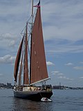 | September 25, 1997 (#97001278) | Boston Harbor 44°12′38″N 69°03′46″W / 44.210556°N 69.062778°W / 44.210556; -69.062778 (ROSEWAY (Schooner)) | Launched on November 24, 1925 in Essex, this wooden gaff-rigged schooner was used primarily for competitive racing. |
49 | St. Paul's Church |  | December 30, 1970 (#70000730) | 130 Tremont Street Beacon Hill 42°21′21″N 71°03′45″W / 42.3559°N 71.0626°W / 42.3559; -71.0626 (St. Paul's Church) | This Greek Revival church was built in 1819 to a design by Alexander Parris. It was the first Episcopal church built in post-independence Boston, and is now the cathedral church of the Episcopal Diocese of Massachusetts. |
50 | David Sears House |  | December 30, 1970 (#70000731) | 42-43 Beacon Street Beacon Hill 42°21′24″N 71°04′00″W / 42.3568°N 71.0667°W / 42.3568; -71.0667 (David Sears House) | This 1816 townhouse was owned by David Sears, a Boston developer, politician, and philanthropist. The Federal-style structure has a facade of carved granite. |
51 | Shirley-Eustis House | 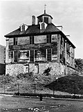 | October 9, 1960 (#66000787) | 33 Shirley St. Roxbury 42°19′25″N 71°04′19″W / 42.3236°N 71.0720°W / 42.3236; -71.0720 (Shirley-Eustis House) | Built in the 1740s by colonial governor William Shirley, this Georgian house was also home to Massachusetts Governor William Eustis. |
52 | Charles Sumner House |  | November 7, 1973 (#73001953) | 20 Hancock St. Beacon Hill 42°21′37″N 71°03′52″W / 42.3604°N 71.0644°W / 42.3604; -71.0644 (Charles Sumner House) | This 1851 Federal-style townhouse was home to Charles Sumner, a US Senator and vocal abolitionist. |
53 | Symphony Hall |  | January 20, 1999 (#99000633) | 301 Massachusetts Ave. Fenway–Kenmore 42°20′33″N 71°05′09″W / 42.3426°N 71.0858°W / 42.3426; -71.0858 (Symphony Hall) | This hall has been home to the Boston Symphony Orchestra since 1900, when it was built to a design by McKim, Mead, and White. The performance space is noted for its excellent acoustics. |
54 | Tremont Street Subway |  | January 29, 1964 (#66000788) | Downtown 42°21′17″N 71°03′50″W / 42.3547°N 71.0640°W / 42.3547; -71.0640 (Tremont Street Subway) | The oldest subway tunnel in North America, this tunnel entered service in 1897, and is still in service today. |
55 | Trinity Church |  | December 30, 1970 (#70000733) | Copley Square Back Bay 42°21′00″N 71°04′29″W / 42.3501°N 71.0746°W / 42.3501; -71.0746 (Trinity Church) | Built in the 1870s to a design by H. H. Richardson, this church is an archetype of the Richardsonian Romanesque style, and is recognized as one of the "Ten Most Significant Buildings in the United States" by the American Institute of Architects. Its congregation dates to the 1730s. |
56 | William Monroe Trotter House | 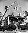 | May 11, 1976 (#76002003) | 97 Sawyer Ave. Dorchester 42°18′46″N 71°03′45″W / 42.3127°N 71.0624°W / 42.3127; -71.0624 (William Monroe Trotter House) | Home of African-American journalist and Harvard graduate William Monroe Trotter. Trotter publisher The Guardian, and meetings of African-American activists, W. E. B. Du Bois among them, took place at this house. |
57 | Union Oyster House | 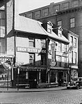 | May 27, 2003 (#03000645) | 41-43 Union St. Downtown 42°21′40″N 71°03′25″W / 42.3612°N 71.0569°W / 42.3612; -71.0569 (Union Oyster House) | This is the oldest operating restaurant in the United States, opened in 1826. The building is at least 100 years older, dating roughly to the first decade of the 18th century. |
Historic areas of the NPS in Boston[edit]
National Historical Parks, some National Monuments, and certain other areas listed in the National Park system are historic landmarks of national importance that are highly protected already, often before the inauguration of the NHL program in 1960, and are then often not also named NHLs per se. There are two of these in Boston. The National Park Service lists these two together with the NHLs in the state,[4]
They are:
Landmark name | Image | Date established | Location | Description | |
|---|---|---|---|---|---|
1 | Boston African American National Historic Site |  | October 10, 1980 | Boston | The Park Service operates two buildings (the African Meeting House and the Abiel Smith School) of 15 locations that comprise this site. All of the site's locations are linked by the Black Heritage Trail, although only a few are open to the public. |
2 | Boston National Historical Park |  | October 1, 1974 | Boston | The Park Service operates eight sites around Boston, most of which are on the Freedom Trail |
See also[edit]
- List of National Historic Landmarks in Massachusetts
- National Register of Historic Places listings in Boston, Massachusetts
References[edit]
^ National Park Service (June 2011). "National Historic Landmarks Program: List of National Historic Landmarks by State" (PDF). Archived from the original (PDF) on 2011-11-05. Retrieved 2011-07-06..mw-parser-output cite.citation{font-style:inherit}.mw-parser-output q{quotes:"""""""'""'"}.mw-parser-output code.cs1-code{color:inherit;background:inherit;border:inherit;padding:inherit}.mw-parser-output .cs1-lock-free a{background:url("//upload.wikimedia.org/wikipedia/commons/thumb/6/65/Lock-green.svg/9px-Lock-green.svg.png")no-repeat;background-position:right .1em center}.mw-parser-output .cs1-lock-limited a,.mw-parser-output .cs1-lock-registration a{background:url("//upload.wikimedia.org/wikipedia/commons/thumb/d/d6/Lock-gray-alt-2.svg/9px-Lock-gray-alt-2.svg.png")no-repeat;background-position:right .1em center}.mw-parser-output .cs1-lock-subscription a{background:url("//upload.wikimedia.org/wikipedia/commons/thumb/a/aa/Lock-red-alt-2.svg/9px-Lock-red-alt-2.svg.png")no-repeat;background-position:right .1em center}.mw-parser-output .cs1-subscription,.mw-parser-output .cs1-registration{color:#555}.mw-parser-output .cs1-subscription span,.mw-parser-output .cs1-registration span{border-bottom:1px dotted;cursor:help}.mw-parser-output .cs1-hidden-error{display:none;font-size:100%}.mw-parser-output .cs1-visible-error{font-size:100%}.mw-parser-output .cs1-subscription,.mw-parser-output .cs1-registration,.mw-parser-output .cs1-format{font-size:95%}.mw-parser-output .cs1-kern-left,.mw-parser-output .cs1-kern-wl-left{padding-left:0.2em}.mw-parser-output .cs1-kern-right,.mw-parser-output .cs1-kern-wl-right{padding-right:0.2em}.
^ Numbers represent an ordering by significant words. Various colorings, defined here, differentiate National Historic Landmarks and historic districts from other NRHP buildings, structures, sites or objects.
^ The eight-digit number below each date is the number assigned to each location in the National Register Information System database, which can be viewed by clicking the number.
^ These are listed on p.113 of "National Historic Landmarks Survey: List of National Historic Landmarks by State", November 2007 version.
External links[edit]
National Park Service (2010-07-09). "National Register Information System". National Register of Historic Places. National Park Service.
Categories:
- National Historic Landmarks in Boston
- Boston-related lists
(window.RLQ=window.RLQ||).push(function(){mw.config.set({"wgPageParseReport":{"limitreport":{"cputime":"1.092","walltime":"1.239","ppvisitednodes":{"value":26734,"limit":1000000},"ppgeneratednodes":{"value":0,"limit":1500000},"postexpandincludesize":{"value":455143,"limit":2097152},"templateargumentsize":{"value":51662,"limit":2097152},"expansiondepth":{"value":11,"limit":40},"expensivefunctioncount":{"value":0,"limit":500},"unstrip-depth":{"value":1,"limit":20},"unstrip-size":{"value":6316,"limit":5000000},"entityaccesscount":{"value":0,"limit":400},"timingprofile":["100.00% 711.851 1 -total"," 76.41% 543.901 57 Template:NRHP_row"," 16.88% 120.181 58 Template:NHL_color"," 16.67% 118.654 55 Template:Designation/color"," 14.81% 105.451 114 Template:First_word"," 12.35% 87.935 57 Template:Coord"," 11.63% 82.759 59 Template:Dts"," 9.67% 68.834 1 Template:Reflist"," 9.06% 64.501 57 Template:NRHP_Focus"," 8.70% 61.932 2 Template:Cite_web"]},"scribunto":{"limitreport-timeusage":{"value":"0.300","limit":"10.000"},"limitreport-memusage":{"value":3123294,"limit":52428800}},"cachereport":{"origin":"mw1246","timestamp":"20181013165842","ttl":1900800,"transientcontent":false}}});mw.config.set({"wgBackendResponseTime":96,"wgHostname":"mw1265"});});


 Clash Royale CLAN TAG