History of California's state highway system
History of California's state highway system
Jump to navigation
Jump to search
Part of a series on the |
|---|
| History of California |
 |
Periods |
|
Topics |
|
Cities |
|
The state highway system in the U.S. state of California dates back to 1896, when the state took over maintenance of the Lake Tahoe Wagon Road. Construction of a large connected system began in 1912, after the state's voters approved an $18 million bond issue for over 3000 miles (4900 km) of highways. The last large addition was made by the California State Assembly in 1959, after which only minor changes have been made.
Contents
1 1895 to 1919
2 1920 to 1958
3 The "Great Renumbering" of 1964
4 1964 to present
5 List of route numbers, 1917-1931
6 See also
7 Notes
8 References
1895 to 1919[edit]

Recommended state highway system, 1896
The first state road was authorized on March 26, 1895, when a law created the post of "Lake Tahoe Wagon Road Commissioner" to maintain the Lake Tahoe Wagon Road (the 1852 Johnson's Cut-off of the California Trail), now US 50 from Smith Flat - 3 miles (5 km) east of Placerville - to the Nevada state line.[1] The 58 mile[2] (93 km) road had been operated as a toll road until 1886, when El Dorado County bought it; the county deeded the road to the state on February 28, 1896.[3] Funding was only enough for minimal improvements, including a stone bridge over the South Fork American River in 1901.[4]

The Bureau of Highways with their buckboard wagon in Riverside County, 1896
Also in 1895, on March 27, the legislature created the three-person Bureau of Highways to coordinate efforts by the counties to build good roads. The bureau traveled to every county of the state in 1895 and 1896 and prepared a map of a recommended system of state roads, which they submitted to the governor on November 25, 1896.[5] The legislature replaced the Bureau of Highways with the Department of Highways on April 1, 1897,[6] three days after it passed a law creating a second state highway from Sacramento to Folsom - another part of what became US 50 - to be maintained by three "Folsom Highway Commissioners".[7] This was the last highway maintained by a separate authority, as the next state road, the Mono Lake Basin State Road (now part of SR 120), was designated by the legislature in 1899 to be built and maintained by the Department of Highways.[8]
Several more state highways were legislated in the next decade, and the legislature passed a law creating the Department of Engineering on March 11, 1907. This new department, in addition to non-highway duties, was to maintain all state highways, including the Lake Tahoe Wagon Road.[9] On March 22, 1909 the "State Highways Act" was passed, taking effect on December 31, 1910 after a successful vote by the people of the state in November. This law authorized the Department of Engineering to issue $18 million in bonds for a "continuous and connected state highway system" that would connect all county seats.[10] To this end, the department created the three-member California Highway Commission on August 8, 1911 to take full charge of the construction and maintenance of this system. As with the 1896 plan by the Bureau of Highways, the Highway Commission traveled the state to determine the best routes,[11] which ended up stretching about 3100 miles (5000 km).[12] Construction began in mid-1912,[13] with groundbreaking on Contract One - now part of SR 82 in San Mateo County - on August 7.[14] Noteworthy portions of the system built by the commission included the Ridge Route in southern California and the Yolo Causeway west from Sacramento.[15]

The Ridge Route, ca. 1920
Because the first bond issue did not provide enough funding, the "State Highways Act of 1915" was approved by the legislature on May 20, 1915 and the voters in November 1916, taking effect on December 31. This gave the Department of Engineering an additional $12 million to complete the original system and $3 million for a further approximately 680 miles (1100 km) specified by the law. At this time, each route was assigned a number from 1 to 34;[16] this system of labeling routes, although never marked with signs, remained until the 1964 renumbering. In 1917, the legislature gave the California Highway Commission statutory recognition, and turned over the approximately 750 miles[17] (1200 km) of roads adopted by legislative act, until then maintained by the State Engineer, to the commission.[13] Where not serving as extensions of existing routes, these - and routes subsequently added legislatively in 1917 and 1919 - were given numbers from 35 to 45. A third bond issue was approved by the voters at a special election on July 1, 1919, and provided $20 million more for the existing routes and the same amount for new extensions totaling about 1800 miles (2900 km), adding Routes 46 to 64 to the system.[18] The three bond issues together totaled 5560 miles (8948 km), of which just over 40% (60% if the 1919 bond issue is left out) was completed or under construction in mid-1920.[19]
1920 to 1958[edit]

San Francisco–Oakland Bay Bridge construction, 1935
The Department of Engineering became part of the new Department of Public Works in 1921, and the California Highway Commission was entirely separated as its own department in 1923.[20] In order to pay for the roads, a 2-cent per gallon gasoline tax was approved in 1923.[20] The legislature continued to add highways to the system, including the Mother Lode Highway (now part of SR 49) in 1921[21] and the Arrowhead Trail (now I-15 north of Barstow) in 1925.[22] In January 1928, the California State Automobile Association and Automobile Club of Southern California, which had already been placing guide and warning signs along state highways, marked the U.S. Highways along several of the most major state highways.[23] The California Toll Bridge Authority was created in 1929 to acquire and operate all toll bridges on state highways,[20] including the San Francisco–Oakland Bay Bridge and Carquinez Bridge.

The state highway system in 1930
After 1927 and 1929, in which no highways were added to the system, the legislature authorized the construction of 23 new routes in 1931,[24] which were numbered from 72 to 80 when not forming extensions of existing routes. Two years later, another 213 sections of highway were added,[25] almost doubling the total length of state highways to about 14000 miles (23000 km);[26] the last-assigned route number jumped from 80 to 202. Many of these new routes, as well as a number of existing routes, were incorporated into the initial system of state sign routes in 1934, also posted by the auto clubs.[20][27]
The Division of Highways took over signage on state highways from the auto clubs in 1947,[20] though at least the Auto Club of Southern California continued to place signs on city streets until 1956.[28]
The "Great Renumbering" of 1964[edit]
In 1963 and 1964, the California Division of Highways implemented a major renumbering of its state highways. The majority of sign routes — those marked for the public — kept their numbers; the main changes were to the legislative routes, which had their numbers changed to match the sign routes. A large number of formerly unsigned routes received sign numbers corresponding to their new legislative numbers. A smaller change was the removal and truncating of many U.S. Routes in favor of the Interstate Highways (designated in 1959), and the renumbering of State Routes that conflicted with Interstate numbers. Some U.S. Routes that were officially removed continued to be signed until the replacement Interstates were completed. The state law authorizing the renumbering was passed on September 20, 1963. Signage changes took place by July 1, 1964.[29]
1964 to present[edit]
This section needs expansion. You can help by adding to it. (March 2013) |
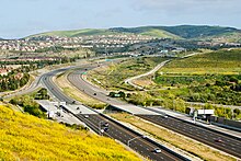
The San Joaquin Hills Toll Road (State Route 73) climbs into the San Joaquin Hills, as seen looking southward from University Hills in Irvine. In the foreground is the tolled Bonita Canyon Drive exit.
A regularly recurring issue in California politics since the 1960s is whether the state should continue to aggressively expand its freeway network or concentrate on improving mass transit networks. Freeway revolts sprang up across the state in the 1960s and 1970s, killing or delaying several projects such as a freeway in San Francisco between the Golden Gate Bridge and the San Francisco–Oakland Bay Bridge, and an expansion of Interstate 710 through South Pasadena.
Both the National Environmental Policy Act of 1969 and the California Environmental Quality Act of 1970 added significant environmental regulations to highway construction. Then in 1972, the Department of Public Works was merged with the Department of Aeronautics to become the modern California Department of Transportation (Caltrans).[30] Now Caltrans not only manages the state highway system, but is also actively involved with public transportation systems throughout the state, and thus is essentially in charge of the entire state's transportation network.
Toll roads and high-occupancy toll lanes began to open across the state beginning in the 1990s. The decade also saw the implementation of FasTrak, California's electronic toll collection (ETC) system, across all toll facilities on state highways. The 91 Express Lanes opened in 1995 along State Route 91 between Anaheim and the Riverside County line, developed as a partnership between Caltrans and the private California Private Transportation Company (CPTC). The Transportation Corridor Agencies, a local agency created by the state, also established three toll roads in Orange California in the 1990s. Another privately financed toll highway project, the South Bay Expressway, began operation in San Diego County in 2007. Several other HOT lanes across various state highway are also either currently under construction or in the planning stages.
List of route numbers, 1917-1931[edit]
| Approximate present number(s) | From | To | History | |
|---|---|---|---|---|
1 | US 101, US 199 | Sausalito | Oregon | 1910 bond issue: Sausalito to Crescent City 1919 bond issue: Crescent City to Oregon |
2 | US 101, I-5 | San Francisco | San Diego | 1910 bond issue: entire route |
3 | I-80, SR 65, SR 99, I-5 | Sacramento | Oregon | 1910 bond issue: entire route |
4 | SR 99, I-5 | Sacramento | Los Angeles | 1910 bond issue: entire route |
5 | I-5, I-205, I-580, SR 238, I-680, SR 17 | Stockton | Santa Cruz, with a branch to Oakland | 1910 bond issue: entire route |
6 | I-80 | Sacramento | Davis | 1910 bond issue: entire route |
7 | I-680, I-80, SR 113, I-5 | Benicia | Red Bluff | 1910 bond issue: entire route |
8 | SR 37, SR 121, SR 12 | Novato | Fairfield | 1910 bond issue: entire route |
9 | SR 118, I-210, SR 66 | San Fernando | San Bernardino | 1910 bond issue: entire route (San Bernardino County seat lateral) |
10 | SR 198 | San Lucas | Sequoia National Park | 1910 bond issue: Hanford to Visalia (Kings County and Tulare County seat lateral) 1916 bond issue: San Lucas to Hanford 1919 bond issue: Visalia to Sequoia National Park |
11 | US 50 | Sacramento | Nevada | 1895 law:[1]Smith Flat to Nevada 1897 law:[7] Sacramento to Folsom 1910 bond issue: Sacramento to Placerville (El Dorado County seat lateral) 1915 law:[31] Placerville to Smith Flat 1919 bond issue: Placerville to Pollock Pines |
12 | I-8 | San Diego | El Centro | 1910 bond issue: entire route (Imperial County seat lateral) |
13 | SR 219, SR 108 | Salida | East of Sonora Pass | 1901 law:[32]Long Barn to east of Sonora Pass 1910 bond issue: Salida to Sonora (Tuolumne County seat lateral) 1919 law:[33] Sonora to Long Barn |
14 | SR 123, I-80 | Oakland | Martinez | 1910 bond issue: entire route (Contra Costa County seat lateral) |
15 | SR 20 | Ukiah | Emigrant Gap | 1910 bond issue: Williams to Colusa (Colusa County seat lateral) 1919 bond issue: Ukiah to Williams and Colusa to Emigrant Gap |
16 | SR 175 | Hopland | Lakeport | 1910 bond issue: entire route (Lake County seat lateral) |
17 | I-80, SR 49 | Roseville | Nevada City | 1910 bond issue: entire route (Placer County and Nevada County seat lateral) |
18 | SR 140 | Merced | Yosemite National Park | 1910 bond issue: Merced to Mariposa (Mariposa County seat lateral) 1915 law:[34] through Yosemite National Park 1916 bond issue: Mariposa to Yosemite National Park |
19 | SR 71, SR 60 | West of Claremont | Riverside | 1910 bond issue: entire route (Riverside County seat lateral) |
20 | SR 299 | Arcata | Redding | 1910 bond issue: Weaverville to Redding (Trinity County seat lateral) 1916 bond issue: Arcata to Salyer and Helena to Weaverville |
21 | SR 162, SR 70 | Richvale | Quincy | 1910 bond issue: Richvale to Oroville as Route 21 (Butte County seat lateral) and Oroville to Quincy as Route 30 (Plumas County seat lateral) 1919 bond issue: Oroville to Quincy as Route 21 |
22 | SR 156 | North of Hollister | San Juan Bautista | 1910 bond issue: Hollister to San Juan Bautista (San Benito County seat lateral) 1919 bond issue: north of Hollister to Hollister |
23 | SR 14, US 395, SR 89 | Saugus | South Lake Tahoe | 1901 law:[32] Bridgeport to east of Sonora Pass 1910 bond issue: Saugus to Bridgeport (Inyo County and Mono County seat lateral) 1911 law:[35] east of Sonora Pass to South Lake Tahoe |
24 | SR 12, SR 49, SR 4 | Lodi | Southeast of Markleeville | 1910 bond issue: Lodi to San Andreas (Calaveras County seat lateral) 1911 law:[35]Calaveras Big Trees to southeast of Markleeville 1921 law:[21] San Andreas to Angels Camp 1925 law:[36] Angels Camp to Calaveras Big Trees |
25 | SR 49 | Nevada City | Downieville | 1910 bond issue: entire route (Sierra County seat lateral) |
26 | I-10, SR 86 | San Bernardino | El Centro | 1916 bond issue: entire route |
27 | I-8 | El Centro | Arizona | 1916 bond issue: entire route |
28 | SR 299 | Redding | Nevada | 1910 bond issue: Redding to Alturas (Modoc County seat lateral) 1911 law:[37]Pittville to Adin 1921 law:[38] Alturas to Nevada |
29 | SR 36, US 395 | Red Bluff | Nevada | 1910 bond issue: Red Bluff to Susanville (Lassen County seat lateral) 1919 bond issue: Susanville to Nevada |
30 | SR 70 | Oroville | Quincy | See Route 21 |
31 | I-215, I-15 | San Bernardino | Nevada | 1916 bond issue: San Bernardino to Barstow 1925 law:[22] Barstow to Nevada |
32 | SR 152 | Chowchilla | Gilroy | 1916 bond issue: entire route |
33 | SR 46 | Bakersfield | Paso Robles | 1916 bond issue: entire route |
34 | SR 104, SR 88 | Galt | Southeast of Luther Pass | 1910 bond issue: Galt to Jackson (Amador County seat lateral) 1911 law:[35] Jackson to southeast of Luther Pass |
35 | SR 36, SR 3 | Mad River | Peanut | 1907 law:[39] entire route |
36 | N/A | Northwest of Downieville | Downieville | 1907 law:[40] entire route |
37 | I-80 | Auburn | Truckee | 1909 law:[41]Emigrant Gap to Donner Lake 1915 law:[42] Donner Lake to Truckee 1915 law:[43] Auburn to Emigrant Gap 1919 bond issue: entire route |
38 | SR 89, I-80 | South Lake Tahoe | Nevada | 1911 law:[44] South Lake Tahoe to Homewood 1915 law:[42] Homewood to Truckee 1919 law:[45] Truckee to Nevada 1919 bond issue: Tahoe City to Nevada |
39 | SR 28 | Tahoe City | Nevada | 1915 law:[46] entire route |
40 | SR 120 | West of Chinese Camp | Lee Vining | 1899 law:[8]Yosemite National Park to west of Lee Vining 1915 law:[47] through Yosemite National Park 1915 law:[34] west of Chinese Camp to Yosemite National Park 1917 law:[48] west of Lee Vining to Lee Vining |
41 | SR 180 | General Grant Grove | Kings Canyon | 1909 law:[49] entire route 1919 bond issue: entire route |
42 | SR 9, SR 236 | Saratoga Gap | Big Basin Redwoods State Park | 1913 law:[50] entire route |
43 | SR 18 | Waterman Canyon | Big Bear Lake | 1917 law:[51] Waterman Canyon to east end of Big Bear Lake via north side 1919 bond issue: Arrowbear Lake to Metcalf Bay on south side of Big Bear Lake |
44 | SR 236 | Boulder Creek | Big Basin Redwoods State Park | 1913 law:[50] within the park 1917 law:[52] outside the park |
45 | SR 162 | Biggs | Willows | 1919 law:[53] entire route |
46 | SR 96, SR 169 | North of Yreka | Klamath | 1919 bond issue: entire route |
47 | SR 32 | Orland | Chico | 1919 bond issue: entire route |
48 | SR 128 | Cloverdale | Albion | 1919 bond issue: entire route |
49 | SR 29, SR 53 | Calistoga | North of Lower Lake | 1919 bond issue: Calistoga to Lower Lake as Route 49 and Lower Lake to north of Lower Lake as Route 50 |
50 | SR 16 | Northeast of Lower Lake | Rumsey | 1919 bond issue: entire route |
51 | SR 12 | Santa Rosa | Sonoma | 1919 bond issue: entire route |
52 | SR 131 | Tiburon | Mill Valley | 1919 bond issue: entire route |
53 | SR 12 | Fairfield | Lodi | 1919 bond issue: Fairfield to Rio Vista 1921 law:[54] Rio Vista to Lodi |
54 | SR 16 | East of Sloughhouse | Plymouth | 1919 bond issue: entire route |
55 | SR 35 | San Francisco | North of Santa Cruz | 1919 bond issue: entire route |
56 | SR 1 | Cambria | Carmel | 1919 bond issue: San Simeon to Carmel 1921 law:[55] Cambria to San Simeon |
57 | SR 166, SR 119, SR 178 | Santa Maria | Freeman Junction | 1919 bond issue: entire route |
58 | SR 58, I-40 | Mojave | Arizona | 1919 bond issue: Mojave to Needles 1925 law:[56] Needles to Arizona |
59 | SR 138 | Gorman | Lancaster | 1919 bond issue: entire route |
60 | SR 1 | El Rio | San Juan Capistrano | 1919 bond issue: Oxnard to San Juan Capistrano 1925 law:[57] El Rio to Oxnard |
61 | SR 2 | La Canada Flintridge | Red Box Gap | 1919 bond issue: entire route |
62 | SR 39 | Azusa | San Gabriel Canyon | 1919 bond issue: entire route |
63 | SR 168 | Big Pine | Oasis | 1919 bond issue: entire route |
64 | I-10 | Mecca | Blythe | 1919 bond issue: entire route |
65 | SR 49 | Auburn | Sonora | 1921 law:[21] entire route |
66 | SR 120 | Lathrop | Manteca | 1921 law:[58] entire route |
67 | SR 129 | San Juan Bautista | Chittenden | 1921 law:[59] entire route |
68 | US 101 | San Francisco | San Jose | 1923 and 1925 laws:[60][61] entire route |
69 | I-580 | San Rafael | Point San Quentin | 1925 law:[62] entire route |
70 | SR 222 | Ukiah | Mendocino State Hospital | 1925 law:[63] entire route |
71 | US 101 | Crescent City | Oregon | 1925 law:[64] entire route |
See also[edit]
- Butterfield Overland Mail
- California Trail
- El Camino Real (California)
- El Camino Viejo
- Rincon Sea Level Road
- Southern Emigrant Trail
- Stockton – Los Angeles Road
Notes[edit]
^ ab "An act to authorize the state of California to secure the title to and right of way for that certain wagon-road...commencing a short distance easterly from the village of Smith's Flat...and running thence to Lake Tahoe...", approved March 26, 1895, chapter 128, p. 119
^ Report of the Lake Tahoe Wagon Road Commissioner, November 29, 1898
^ California Highways and Public Works, Centennial Edition, September 9, 1950
^ Department of Engineering (1917), p. 181
^ Blow, pp. 12-15
^ Blow, p. 18
^ ab "An act to provide for the construction of a state highway or wagon road from Sacramento City to Folsom...", approved March 29, 1897, chapter 176, p. 239
^ ab "An act to provide for the construction of a free wagon road from the Mono lake basin to connect with a road called 'Tioga road,' at or near the 'Tioga mine,' and making an appropriation therefor.", approved February 23, 1899, chapter 26, p. 26
^ "An act to create for the State of California a department of engineering...", approved March 11, 1907, chapter 183, p. 215
^ "An act authorizing the construction, acquisition, maintenance and control of a system of state highways in the State of California...", approved March 22, 1909, chapter 383, p. 647
^ Blow, pp. 27-34
^ Howe & Peters, p. 12
^ ab Automobile Clubs, p. 16
^ Blow, p. 2
^ Department of Engineering (1917), p. 198
^ Howe & Peters, pp. 11-14
^ Home & Peters, p. 18
^ Howe & Peters, pp. 12-14
^ How & Peters, p. 17
^ abcde California Department of Transportation, Fact Sheet: Important Events in Caltrans History
^ abc "An act declaring the public highway extending from Auburn in Placer County to the Sonora Lateral at Sonora in Tuolumne county to be a state highway.", approved June 3, 1921, chapter 839, p. 1608
^ ab "An act authorizing and directing the California highway commission to acquire necessary rights of way, and to construct and maintain a highway, which is hereby declared to be a state highway, extending from Barstow...to a point...on the boundary line between the state of California and the state of Nevada...which said highway is commonly known and referred to as the Arrowhead trail.", approved May 23, 1925, chapter 369, p. 670
^ Route Renumbering, California Highways and Public Works, March–April 1964, p. 11
^ "An act establishing certain additional state highways and classifying them as secondary highways", approved April 1, 1931, chapter 82, p. 102, in effect August 14, 1931
^ 1933, chapter 767, p. 2034
^ Joint Fact-Finding Committee on Highways, Streets and Bridges, California's Highway Problem, 1947, OCLC 4650558, p. 29
^ State Routes will be Numbered and Marked with Distinctive Bear Signs, California Highways and Public Works, August 1934
^ Richard R. Mathison, Three Cars in Every Garage: A Motorist's History of the Automobile and the Automobile Club in Southern California, Doubleday, 1968, OCLC 435368, p. 240
^ California Highways and Public Works, March–April 1964, Route Renumbering (PDF)
^ Raymond Forsyth and Joseph Hagwood, One Hundred Years of Progress (Sacramento: California Transportation Foundation, 1996)128.
^ "An act declaring the wagon road extending from the western end of the Lake Tahoe state wagon road to the eastern limits of the city of Placerville to be a state highway.", approved April 10, 1915, chapter 32, p. 41
^ ab "An act to declare a part of the Sonora and Mono wagon road, commencing east of Sonora, at a point known as Long Barn...and running thence across the summit of the Sierra Nevada Mountains to Bridgeport...a state highway.", approved March 12, 1901, chapter 111, p. 272
^ "An act declaring the public highway extending from Long Barn...to the eastern boundary of the city of Sonora to be a public state highway.", approved May 27, 1919, chapter 510, p. 1069
^ ab "An act to take title to and thereafter maintain as a state highway, the toll road in Tuolumne and Mariposa counties, known as the Big Oak Flat and Yosemite road, also a section of Tuolumne county road to connect said toll road with the Sonora lateral of the state highway.", approved May 19, 1915, chapter 396, p. 635
^ abc "An act to establish the Alpine state highway; to define its course...", approved April 15, 1911, chapter 468, p. 931
^ "An act declaring the county road in Calaveras county, extending from Angels Camp through Vallecita and Murphy to Calaveras Big Trees in the national forest to be a state highway.", approved May 23, 1925, chapter 375, p. 689
^ "An act declaring a state highway from the Shasta county line through Lassen county to the Modoc county line...", approved April 22, 1911, chapter 498, p. 1036
^ "An act making an appropriation to pay the cost of making a survey and preparing plans and estimates for the construction of a highway from the town of Alturas in Modoc county to the Nevada-California state line by the most direct and practical route via Cedarville connecting with the proposed Nevada state highway.", approved June 3, 1921, chapter 888, p. 1685
^ "An act to provide for the survey, location and construction of a state highway connecting the present county road systems of any one or all of the counties of Trinity, Tehama and Shasta with the road system of Humboldt County...", approved March 23, 1907, chapter 117, p. 139
^ "An act to make an appropriation for the location, survey and construction of a state highway from a point known as the Mount Pleasant ranch on the road between Quincy and Marysville thence in a southeasterly direction by Eureka to Downieville, Sierra County.", approved March 8, 1907, chapter 116, p. 138
^ "An act to make an appropriation for the location, survey and construction of a state highway from Emigrant Gap...to the west end of Donner Lake...", approved March 13, 1909, chapter 224, p. 352
^ ab "An act declaring the wagon road from McKinney's to the west end of Donner Lake a state highway." approved May 18, 1915, chapter 203, p. 441
^ "An act declaring the county road extending from Auburn...to a point near Emigrant Gap, a state highway...", approved June 9, 1915, chapter 678, p. 1327
^ "An act to provide a state highway from Meyer's station...to McKinney's...", approved March 9, 1911, chapter 158, p. 324
^ "An act declaring and establishing a state highway from the town of Truckee running in a northeasterly direction along the present traveled road to the Nevada state line near Verdi.", approved April 15, 1919, chapter 66, p. 102
^ "An act making an appropriation for the location, survey and construction of a state highway from Tahoe city...along the northern boundary of Lake Tahoe to the western boundary of the State of Nevada at Crystal Bay...", approved June 9, 1915, chapter 680, p. 1328
^ "An act to appropriate money to purchase a portion of the Great Sierra Wagon Road and to provide for the acceptance and maintenance of said road as a state road.", approved May 18, 1915, chapter 306, p. 488
^ "An act extending the Mono Lake basin state road easterly to a junction with the county road from Mono Lake postoffice to Mono Mills.", approved May 29, 1917, chapter 704, p. 1326
^ "An act to provide for the continuation of the construction of the highway known as King's river highway, to declare it a state highway...", approved March 13, 1909, chapter 223, p. 351
^ ab "An act to provide for the survey and construction of a state highway from Saratoga Gap, on the line between the counties of Santa Clara and Santa Cruz, to, into and within California Redwood Park...", approved June 13, 1913, chapter 398, p. 855
^ "An act declaring and establishing a state highway from the city of San Bernardino, by way of Arrowhead avenue, Waterman canyon, the 'Crest drive' and Mill creek to the city of Redlands.", approved May 29, 1917, chapter 697, p. 1314
^ "An act providing for the taking over by the state of California of a certain road in Boulder Creek township...and for the maintenance and improvement of the same as a state highway...", approved May 29, 1917, chapter 703, p. 1325
^ "An act declaring and establishing a state highway between the present state highway in Butte county and the present state highway in Glenn county, over existing county roads passing through Butte city and Glenn postoffice to Willows.", approved May 27, 1919, chapter 542, p. 1190
^ "An act declaring the improved county road extending from Rio Vista to Lodi to be a state highway.", approved June 3, 1921, chapter 831, p. 1597
^ "An act declaring the county road extending from San Simeon to Cambria to be a state highway and providing for the maintenance thereof.", approved June 3, 1921, chapter 837, p. 1606
^ "An act authorizing and directing the California highway commission to acquire necessary rights of way, and to construct and maintain...a state highway, extending from Needles...to a point...on the boundary line between the State of California and the state of Arizona opposite the town of Topock, Arizona...", approved May 22, 1925, chapter 279, p. 463
^ "An act authorizing and directing the California highway commission to acquire necessary rights of way and to construct and maintain...a state highway, extending from the town of Oxnard to a point...upon the state highway extending from Los Angeles to Ventura, such point to be at or near the town of El Rio...", approved May 22, 1925, chapter 309, p. 508
^ "An act providing for the taking over by the State of California of a certain road in the county of San Joaquin...", approved June 3, 1921, chapter 845, p. 1627
^ "An act declaring and establishing a state highway between a point near Chittenden station in San Benito county, to a point on route two of the state highway in the vicinity of San Benito river bridge.", approved June 3, 1921, chapter 836, p. 1606
^ "An act authorizing and directing the California highway commission to lay out and acquire a right of way or rights of way for a highway or highways from the county line of the city and county of San Francisco, in, to and through San Mateo county...", approved May 18, 1923, chapter 181, p. 422
^ "An act to provide for the establishment of a highway, to be known as the Bay Shore highway, in the counties of San Francisco, San Mateo and Santa Clara.", approved May 23, 1925, chapter 471, p. 1009
^ "An act declaring the public highway extending from Irwin street within the corporate limits of the city of San Rafael, in Marin county, California, to Point San Quentin, in Marin county, California, to be a state highway.", approved April 20, 1925, chapter 82, p. 190
^ "An act providing for the taking over by the State of California of a certain road in the county of Mendocino and declaring the same to be a state highway...", approved May 23, 1925, chapter 351, p. 635
^ "An act providing for the taking over by the State of California of a certain road in the county of Del Norte, and declaring the same to be a state highway...", approved May 23, 1925, chapter 335, p. 572
References[edit]
Department of Engineering, Fifth Biennial Report of the Department of Engineering of the State of California, December 1, 1914, to November 30, 1916, 1917- Ben Blow, California Highways: A Descriptive Record of Road Development by the State and by Such Counties as Have Paved Highways, 1920 (Archive.org or Google Books)
- Howe & Peters, Engineers' Report to California State Automobile Association Covering the Work of the California Highway Commission for the Period 1911-1920
Automobile Club of Southern California and California State Automobile Association, The State Highways of California: An Engineering Study, 1921
Categories:
- State highways in California
- History of California
- History of transportation in the United States
- Road transportation in California
(window.RLQ=window.RLQ||).push(function(){mw.config.set({"wgPageParseReport":{"limitreport":{"cputime":"0.588","walltime":"0.666","ppvisitednodes":{"value":3494,"limit":1000000},"ppgeneratednodes":{"value":0,"limit":1500000},"postexpandincludesize":{"value":97306,"limit":2097152},"templateargumentsize":{"value":14740,"limit":2097152},"expansiondepth":{"value":8,"limit":40},"expensivefunctioncount":{"value":2,"limit":500},"unstrip-depth":{"value":0,"limit":20},"unstrip-size":{"value":30599,"limit":5000000},"entityaccesscount":{"value":0,"limit":400},"timingprofile":["100.00% 338.445 1 -total"," 33.29% 112.652 70 Template:Sort"," 20.30% 68.701 1 Template:California_history"," 19.53% 66.096 1 Template:California_topic"," 13.06% 44.208 1 Template:Reflist"," 11.82% 39.999 1 Template:California_history_sidebar"," 10.78% 36.482 2 Template:Navbox"," 10.59% 35.851 1 Template:Sidebar"," 9.01% 30.478 1 Template:Expand_section"," 7.64% 25.861 1 Template:Ambox"]},"scribunto":{"limitreport-timeusage":{"value":"0.099","limit":"10.000"},"limitreport-memusage":{"value":2998821,"limit":52428800}},"cachereport":{"origin":"mw1251","timestamp":"20181028140752","ttl":1900800,"transientcontent":false}}});mw.config.set({"wgBackendResponseTime":83,"wgHostname":"mw1239"});});

 Clash Royale CLAN TAG

