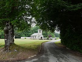
Confolent-Port-Dieu
Confolent-Port-Dieu
Jump to navigation
Jump to search
| Confolent-Port-Dieu | ||
|---|---|---|
Commune | ||
 The church in Confolent-Port-Dieu | ||
| ||
 Confolent-Port-Dieu Location within Nouvelle-Aquitaine region  Confolent-Port-Dieu | ||
Coordinates: 45°32′39″N 2°29′50″E / 45.5442°N 2.4972°E / 45.5442; 2.4972Coordinates: 45°32′39″N 2°29′50″E / 45.5442°N 2.4972°E / 45.5442; 2.4972 | ||
| Country | France | |
| Region | Nouvelle-Aquitaine | |
| Department | Corrèze | |
| Arrondissement | Ussel | |
| Canton | Haute-Dordogne | |
| Intercommunality | Haute-Corrèze Communauté | |
| Government | ||
| • Mayor (2008–2014) | Martine Jamin | |
| Area1 | 8.47 km2 (3.27 sq mi) | |
| Population (2008)2 | 29 | |
| • Density | 3.4/km2 (8.9/sq mi) | |
| Time zone | UTC+1 (CET) | |
| • Summer (DST) | UTC+2 (CEST) | |
INSEE/Postal code | 19167 /19200 | |
| Elevation | 520–786 m (1,706–2,579 ft) | |
1 French Land Register data, which excludes lakes, ponds, glaciers > 1 km2 (0.386 sq mi or 247 acres) and river estuaries. 2Population without double counting: residents of multiple communes (e.g., students and military personnel) only counted once. | ||
This article may be expanded with text translated from the corresponding article in French. (January 2009) Click [show] for important translation instructions.
|
Confolent-Port-Dieu is a commune in the Corrèze department in central France.
Contents
1 Geography
2 Population
3 See also
4 References
Geography[edit]
The Chavanon forms the commune's northeastern boundary, then flows into the Dordogne, which forms the commune's eastern boundary.
Population[edit]
| Historical population | ||
|---|---|---|
| Year | Pop. | ±% |
| 1962 | 48 | — |
| 1968 | 57 | +18.8% |
| 1975 | 40 | −29.8% |
| 1982 | 30 | −25.0% |
| 1990 | 38 | +26.7% |
| 1999 | 39 | +2.6% |
| 2008 | 29 | −25.6% |
See also[edit]
- Communes of the Corrèze department
References[edit]
- INSEE
| Wikimedia Commons has media related to Confolent-Port-Dieu. |
This Corrèze geographical article is a stub. You can help Wikipedia by expanding it. |
Categories:
- Communes of Corrèze
- Corrèze geography stubs
(window.RLQ=window.RLQ||).push(function(){mw.config.set({"wgPageParseReport":{"limitreport":{"cputime":"0.780","walltime":"0.923","ppvisitednodes":{"value":4937,"limit":1000000},"ppgeneratednodes":{"value":0,"limit":1500000},"postexpandincludesize":{"value":109736,"limit":2097152},"templateargumentsize":{"value":26607,"limit":2097152},"expansiondepth":{"value":26,"limit":40},"expensivefunctioncount":{"value":7,"limit":500},"unstrip-depth":{"value":0,"limit":20},"unstrip-size":{"value":52,"limit":5000000},"entityaccesscount":{"value":1,"limit":400},"timingprofile":["100.00% 793.395 1 -total"," 87.81% 696.700 1 Template:Infobox_French_commune"," 85.29% 676.670 1 Template:Infobox_settlement"," 72.63% 576.208 1 Template:Infobox"," 7.45% 59.079 8 Template:Both"," 7.08% 56.149 1 Template:Coord"," 5.82% 46.173 1 Template:Short_description"," 5.20% 41.257 2 Template:Location_map"," 4.91% 38.935 1 Template:Expand_French"," 4.27% 33.841 1 Template:Expand_language"]},"scribunto":{"limitreport-timeusage":{"value":"0.479","limit":"10.000"},"limitreport-memusage":{"value":5388941,"limit":52428800}},"cachereport":{"origin":"mw1270","timestamp":"20181018154221","ttl":1900800,"transientcontent":false}}});mw.config.set({"wgBackendResponseTime":90,"wgHostname":"mw1239"});});


 Clash Royale CLAN TAG