Middlesex County, Connecticut
Middlesex County, Connecticut
Jump to navigation
Jump to search
Middlesex County, Connecticut | |
|---|---|
| County of Connecticut | |
| County of Middlesex | |
 Raymond E Baldwin Courthouse | |
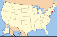
 Location in the U.S. state of Connecticut | |
 Connecticut's location in the U.S. | |
| Founded | May, 1785 |
| Seat | none (since 1960) Middletown (before 1960) |
| Largest city | Middletown |
| Area | |
| • Total | 439 sq mi (1,137 km2) |
| • Land | 369 sq mi (956 km2) |
| • Water | 70 sq mi (181 km2), 15.9% |
| Population (est.) | |
| • (2016) | 163,329 |
| • Density | 449/sq mi (173/km2) |
| Congressional districts | 1st, 2nd, 3rd |
| Time zone | Eastern: UTC−5/−4 |
Middlesex County is a county in the south central part of the U.S. state of Connecticut. As of the 2010 census, the population was 165,676.[1] The county was created in May 1785 from portions of Hartford County and New London County.
Middlesex County is included in the Hartford-West Hartford-East Hartford metropolitan statistical area known as Greater Hartford.
As with all eight of Connecticut's counties, there is now no county government and no county seat. In Connecticut, towns are responsible for all local government activities, including local police, fire and rescue, snow removal, and schools. In a few cases, neighboring towns will share certain resources, e.g. water, gas, etc. Counties in Connecticut serve merely as dividing lines for the state's judicial system.
Contents
1 Government
2 Geography
2.1 Adjacent counties
2.2 National protected areas
3 Demographics
3.1 2000 census
3.2 2010 census
3.3 Demographic breakdown by town
3.3.1 Income
3.3.2 Race
4 Communities
4.1 City
4.2 Towns
5 Politics
6 See also
7 References
8 External links
Government[edit]
Middletown was the county seat of Middlesex County from its creation in 1785 until the elimination of county government in 1960. There is no government in Middlesex County other than the Middlesex County Judicial District. All county functions other than courts and county sheriff's departments were discontinued in 1960, and again in 2000 when the county sheriff's departments were reorganized as the Connecticut Judicial Marshal, due to political corruption in the county sheriff's departments. Joseph E. Bibisi was the last person to serve as high sheriff of Middlesex County.
Geography[edit]
The county has a total area of 439 square miles (1,140 km2), of which 369 square miles (960 km2) is land and 70 square miles (180 km2) (15.9%) is water.[2] It is the smallest county in Connecticut by land area and second-smallest by total area.
The terrain trends from mostly level along the Connecticut River and Atlantic coast to gently rolling uplands away from them. The highest elevation is close to a triangulation station in Meshomasic State Forest, at 916 feet (279 m) above sea level; the lowest point is sea level.
Middlesex County is also the home of Wadsworth Falls.
Adjacent counties[edit]
Hartford County (north)
New London County (east)
New Haven County (west)
Suffolk County (south)
National protected areas[edit]
Silvio O. Conte National Wildlife Refuge (part)
Stewart B. McKinney National Wildlife Refuge (part)
Demographics[edit]
| Historical population | |||
|---|---|---|---|
| Census | Pop. | %± | |
| 1790 | 18,828 | — | |
| 1800 | 19,874 | 5.6% | |
| 1810 | 20,723 | 4.3% | |
| 1820 | 22,405 | 8.1% | |
| 1830 | 24,844 | 10.9% | |
| 1840 | 24,879 | 0.1% | |
| 1850 | 27,216 | 9.4% | |
| 1860 | 30,859 | 13.4% | |
| 1870 | 36,099 | 17.0% | |
| 1880 | 35,589 | −1.4% | |
| 1890 | 39,524 | 11.1% | |
| 1900 | 41,760 | 5.7% | |
| 1910 | 45,637 | 9.3% | |
| 1920 | 47,550 | 4.2% | |
| 1930 | 51,388 | 8.1% | |
| 1940 | 55,999 | 9.0% | |
| 1950 | 67,332 | 20.2% | |
| 1960 | 88,865 | 32.0% | |
| 1970 | 114,816 | 29.2% | |
| 1980 | 129,017 | 12.4% | |
| 1990 | 143,196 | 11.0% | |
| 2000 | 155,071 | 8.3% | |
| 2010 | 165,676 | 6.8% | |
| Est. 2016 | 163,329 | [3] | −1.4% |
| U.S. Decennial Census[4] 1790-1960[5] 1900-1990[6] 1990-2000[7] 2010-2016[1] | |||
2000 census[edit]
As of the census[8] of 2000, there were 155,071 people, 61,341 households, and 40,607 families residing in the county. The population density was 420 people per square mile (162/km²). There were 67,285 housing units at an average density of 182 per square mile (70/km²). According to the Census of 2010, the racial makeup of the county was 89.22% White, 4.64% Black or African American, 0.17% Native American, 2.56% Asian, 0.04% Pacific Islander, 1.30% from other races, and 2.06% from two or more races. 4.73% of the population were Hispanic or Latino of any race. 20.4% were of Italian, 14.3% Irish, 11.1% English, 8.9% Polish and 8.2% German ancestry. 91.1% spoke English, 2.6% Spanish, 1.9% Italian, 1.2% French and 1.0% Polish as their first language.
There were 61,341 households out of which 30.30% had children under the age of 18 living with them, 54.40% were married couples living together, 8.80% had a female householder with no husband present, and 33.80% were non-families. 27.20% of all households were made up of individuals and 10.00% had someone living alone who was 65 years of age or older. The average household size was 2.43 and the average family size was 2.98.
In the county, the population was spread out with 23.20% under the age of 18, 7.30% from 18 to 24, 31.10% from 25 to 44, 24.80% from 45 to 64, and 13.60% who were 65 years of age or older. The median age was 39 years. For every 100 females, there were 95.10 males. For every 100 females age 18 and over, there were 92.10 males.
The median income for a household in the county was $59,175, and the median income for a family was $71,319. Males had a median income of $48,341 versus $35,607 for females. The per capita income for the county was $28,251. About 2.30% of families and 4.60% of the population were below the poverty line, including 4.00% of those under age 18 and 5.90% of those age 65 or over.
2010 census[edit]
As of the 2010 United States Census, there were 165,676 people, 67,202 households, and 43,743 families residing in the county.[9] The population density was 448.6 inhabitants per square mile (173.2/km2). There were 74,837 housing units at an average density of 202.6 per square mile (78.2/km2).[10] The racial makeup of the county was 89.2% white, 4.7% black or African American, 2.6% Asian, 0.2% American Indian, 1.3% from other races, and 2.1% from two or more races. Those of Hispanic or Latino origin made up 4.7% of the population.[9] In terms of ancestry, 24.6% were Italian, 21.2% were Irish, 14.0% were English, 13.5% were German, 11.1% were Polish, and 3.4% were American.[11]
Of the 67,202 households, 29.4% had children under the age of 18 living with them, 51.9% were married couples living together, 9.4% had a female householder with no husband present, 34.9% were non-families, and 28.2% of all households were made up of individuals. The average household size was 2.39 and the average family size was 2.95. The median age was 43.1 years.[9]
The median income for a household in the county was $74,906 and the median income for a family was $91,589. Males had a median income of $62,031 versus $50,031 for females. The per capita income for the county was $37,519. About 3.0% of families and 6.1% of the population were below the poverty line, including 6.7% of those under age 18 and 4.3% of those age 65 or over.[12]
Demographic breakdown by town[edit]
Income[edit]
Data is from the 2010 United States Census and the 2006-2010 American Community Survey 5-Year Estimates.[13][14]
| Rank | Town | Per capita income | Median household income | Median family income | Population | Number of households | |
|---|---|---|---|---|---|---|---|
| 1 | Fenwick | Borough | $110,127 | $114,375 | $250,000+ | 43 | 26 |
| 2 | Essex | Town | $57,365 | $87,480 | $105,982 | 6,683 | 2,916 |
| 3 | Killingworth | Town | $45,404 | $99,500 | $108,232 | 6,525 | 2,474 |
| 4 | Old Saybrook | Town | $43,400 | $79,985 | $99,595 | 10,242 | 4,247 |
| 5 | Cromwell | Town | $41,926 | $82,012 | $99,362 | 14,005 | 5,752 |
| 6 | Chester | Town | $40,783 | $80,185 | $89,760 | 3,994 | 1,714 |
| 7 | Durham | Town | $39,579 | $105,417 | $110,583 | 7,388 | 2,610 |
| 8 | Portland | Town | $39,100 | $86,661 | $96,016 | 9,508 | 3,822 |
| 9 | Westbrook | Town | $38,158 | $61,069 | $72,969 | 6,938 | 2,948 |
| 10 | Haddam | Town | $37,324 | $86,179 | $100,343 | 8,346 | 3,218 |
| 11 | East Haddam | Town | $37,156 | $82,695 | $86,023 | 9,126 | 3,593 |
| 12 | Clinton | Town | $37,117 | $74,174 | $82,839 | 13,260 | 5,303 |
| 13 | Middlefield | Town | $36,747 | $80,392 | $94,432 | 4,425 | 1,742 |
| 14 | Deep River | Town | $35,564 | $65,250 | $81,641 | 4,629 | 1,940 |
| 15 | East Hampton | Town | $34,555 | $88,281 | $95,854 | 12,959 | 5,060 |
| 16 | Middletown | City | $31,348 | $57,655 | $78,006 | 47,648 | 19,863 |
Race[edit]
Data is from the 2007-2011 American Community Survey 5-Year Estimates, ACS Demographic and Housing Estimates, "Race alone or in combination with one or more other races."[15]
| Rank | Town | Population | White | Black | Asian | American Indian | Other | Hispanic | |
|---|---|---|---|---|---|---|---|---|---|
| 1 | Middletown | City | 47,510 | 79.2% | 15.7% | 4.9% | 0.6% | 3.2% | 8.1% |
| 2 | Cromwell | Town | 13,951 | 93.2% | 3.9% | 3.3% | 0.3% | 0.5% | 4.2% |
| 3 | Clinton | Town | 13,291 | 95.8% | 0.5% | 2.1% | 0.2% | 1.8% | 3.5% |
| 4 | East Hampton | Town | 12,926 | 95.4% | 1.6% | 1.7% | 0.3% | 1.9% | 3.8% |
| 5 | Old Saybrook | Town | 10,307 | 97.8% | 0.7% | 1.8% | 0.6% | 0.0% | 0.4% |
| 6 | Portland | Town | 9,470 | 96.2% | 2.2% | 1.0% | 0.2% | 1.9% | 4.4% |
| 7 | East Haddam | Town | 9,069 | 99.3% | 1.2% | 0.0% | 0.2% | 0.7% | 0.9% |
| 8 | Haddam | Town | 8,267 | 98.5% | 1.5% | 0.5% | 1.5% | 0.2% | 2.6% |
| 9 | Durham | Town | 7,342 | 94.7% | 0.5% | 3.1% | 0.2% | 3.2% | 5.3% |
| 10 | Westbrook | Town | 6,891 | 95.4% | 0.5% | 4.0% | 1.2% | 0.0% | 4.5% |
| 11 | Essex | Town | 6,697 | 98.8% | 0.6% | 1.4% | 0.1% | 0.1% | 0.6% |
| 12 | Killingworth | Town | 6,499 | 96.7% | 0.0% | 7.5% | 1.4% | 0.7% | 3.0% |
| 13 | Deep River | Town | 4,652 | 88.7% | 2.0% | 0.3% | 0.8% | 7.5% | 8.6% |
| 14 | Middlefield | Town | 4,418 | 94.3% | 1.7% | 4.2% | 0.0% | 0.7% | 1.5% |
| 15 | Chester | Town | 3,984 | 98.3% | 0.4% | 1.7% | 0.7% | 0.0% | 2.6% |
| 16 | Fenwick | Borough | 51 | 100.0% | 5.9% | 0.0% | 0.0% | 0.0% | 0.0% |
Communities[edit]

Map of Middlesex County, Connecticut showing cities, boroughs, towns, and CDPs
City[edit]
- Middletown
Towns[edit]
Villages are named localities within towns, but have no separate corporate existence from the towns they are in.
- Chester
- Clinton
- Cromwell
Deep River
- Winthrop
- Durham
East Haddam
- Moodus
East Hampton
- Cobalt
- Lake Pocotopaug
- Middle Haddam
Essex
- Essex Village
- Centerbrook
- Ivoryton
Haddam
- Higganum
- Killingworth
Middlefield
- Rockfall
Old Saybrook
- Fenwick
- Old Saybrook Center
- Saybrook Manor
- Portland
- Westbrook
Politics[edit]
| Year | GOP | DEM | Others |
|---|---|---|---|
2016 | 43.9% 38,867 | 51.2% 45,357 | 5.0% 4,400 |
2012 | 41.4% 34,591 | 57.3% 47,855 | 1.3% 1,092 |
2008 | 37.7% 32,918 | 60.7% 52,984 | 1.6% 1,351 |
2004 | 42.0% 35,252 | 56.3% 47,292 | 1.7% 1,440 |
2000 | 37.8% 29,295 | 55.9% 43,319 | 6.2% 4,819 |
1996 | 32.0% 22,960 | 52.5% 37,695 | 15.5% 11,131 |
1992 | 30.4% 24,646 | 42.8% 34,707 | 26.7% 21,674 |
1988 | 50.0% 34,682 | 49.0% 33,946 | 1.0% 716 |
1984 | 59.3% 39,580 | 40.3% 26,915 | 0.3% 227 |
1980 | 45.5% 28,989 | 38.9% 24,768 | 15.6% 9,915 |
1976 | 51.4% 31,115 | 48.1% 29,097 | 0.6% 338 |
1972 | 57.9% 33,249 | 41.1% 23,573 | 1.1% 602 |
1968 | 45.3% 21,999 | 48.9% 23,727 | 5.8% 2,798 |
1964 | 32.5% 14,697 | 67.4% 30,517 | 0.2% 71 |
1960 | 49.9% 22,045 | 50.1% 22,158 | 0.0% 1 |
1956 | 64.8% 25,496 | 35.2% 13,851 | 0.0% 0 |
1952 | 58.4% 22,157 | 41.4% 15,722 | 0.2% 73 |
1948 | 51.6% 16,119 | 46.7% 14,609 | 1.7% 537 |
1944 | 51.1% 14,315 | 48.3% 13,551 | 0.6% 176 |
1940 | 50.7% 13,447 | 49.2% 13,044 | 0.2% 39 |
1936 | 46.3% 10,925 | 52.1% 12,294 | 1.5% 359 |
1932 | 52.8% 10,770 | 45.5% 9,286 | 1.7% 344 |
1928 | 59.9% 11,205 | 39.5% 7,380 | 0.6% 115 |
1924 | 65.2% 9,383 | 27.9% 4,009 | 6.9% 994 |
1920 | 65.2% 8,447 | 32.2% 4,170 | 2.6% 331 |
1916 | 53.4% 4,524 | 44.5% 3,765 | 2.1% 179 |
1912 | 35.4% 2,892 | 41.6% 3,393 | 23.0% 1,878 |
1908 | 61.9% 5,071 | 35.8% 2,935 | 2.2% 183 |
1904 | 60.0% 4,991 | 38.1% 3,167 | 1.9% 160 |
1900 | 60.8% 5,000 | 37.7% 3,102 | 1.5% 121 |
1896 | 62.2% 22,396 | 34.6% 12,463 | 3.2% 1,139 |
1892 | 45.9% 15,777 | 52.4% 18,006 | 1.7% 572 |
1888 | 48.4% 14,934 | 49.4% 15,251 | 2.2% 663 |
1884 | 47.4% 12,293 | 50.0% 12,966 | 2.6% 669 |
See also[edit]
- National Register of Historic Places listings in Middlesex County, Connecticut
References[edit]
^ ab "State & County QuickFacts". United States Census Bureau. Archived from the original on July 14, 2011. Retrieved June 11, 2014..mw-parser-output cite.citation{font-style:inherit}.mw-parser-output q{quotes:"""""""'""'"}.mw-parser-output code.cs1-code{color:inherit;background:inherit;border:inherit;padding:inherit}.mw-parser-output .cs1-lock-free a{background:url("//upload.wikimedia.org/wikipedia/commons/thumb/6/65/Lock-green.svg/9px-Lock-green.svg.png")no-repeat;background-position:right .1em center}.mw-parser-output .cs1-lock-limited a,.mw-parser-output .cs1-lock-registration a{background:url("//upload.wikimedia.org/wikipedia/commons/thumb/d/d6/Lock-gray-alt-2.svg/9px-Lock-gray-alt-2.svg.png")no-repeat;background-position:right .1em center}.mw-parser-output .cs1-lock-subscription a{background:url("//upload.wikimedia.org/wikipedia/commons/thumb/a/aa/Lock-red-alt-2.svg/9px-Lock-red-alt-2.svg.png")no-repeat;background-position:right .1em center}.mw-parser-output .cs1-subscription,.mw-parser-output .cs1-registration{color:#555}.mw-parser-output .cs1-subscription span,.mw-parser-output .cs1-registration span{border-bottom:1px dotted;cursor:help}.mw-parser-output .cs1-hidden-error{display:none;font-size:100%}.mw-parser-output .cs1-visible-error{font-size:100%}.mw-parser-output .cs1-subscription,.mw-parser-output .cs1-registration,.mw-parser-output .cs1-format{font-size:95%}.mw-parser-output .cs1-kern-left,.mw-parser-output .cs1-kern-wl-left{padding-left:0.2em}.mw-parser-output .cs1-kern-right,.mw-parser-output .cs1-kern-wl-right{padding-right:0.2em}
^ "US Gazetteer files: 2010, 2000, and 1990". United States Census Bureau. 2011-02-12. Retrieved 2011-04-23.
^ "Population and Housing Unit Estimates". Retrieved June 9, 2017.
^ "U.S. Decennial Census". United States Census Bureau. Retrieved June 11, 2014.
^ "Historical Census Browser". University of Virginia Library. Retrieved June 11, 2014.
^ "Population of Counties by Decennial Census: 1900 to 1990". United States Census Bureau. Retrieved June 11, 2014.
^ "Census 2000 PHC-T-4. Ranking Tables for Counties: 1990 and 2000" (PDF). United States Census Bureau. Retrieved June 11, 2014.
^ "American FactFinder". United States Census Bureau. Retrieved 2011-05-14.
^ abc "DP-1 Profile of General Population and Housing Characteristics: 2010 Demographic Profile Data". United States Census Bureau. Retrieved 2016-01-12.
^ "Population, Housing Units, Area, and Density: 2010 - County". United States Census Bureau. Retrieved 2016-01-12.
^ "DP02 SELECTED SOCIAL CHARACTERISTICS IN THE UNITED STATES – 2006-2010 American Community Survey 5-Year Estimates". United States Census Bureau. Retrieved 2016-01-12.
^ "DP03 SELECTED ECONOMIC CHARACTERISTICS – 2006-2010 American Community Survey 5-Year Estimates". United States Census Bureau. Retrieved 2016-01-12.
^ "SELECTED ECONOMIC CHARACTERISTICS 2006-2010 American Community Survey 5-Year Estimates". U.S. Census Bureau. Retrieved 2012-11-25.
^ "Profile of General Population and Housing Characteristics: 2010 Demographic Profile Data". U.S. Census Bureau. Archived from the original on 2014-03-05. Retrieved 2012-11-25.
^ "ACS DEMOGRAPHIC AND HOUSING ESTIMATES 2007-2011 American Community Survey 5-Year Estimates". U.S. Census Bureau. Retrieved 2013-01-08.
^ Leip, David. "Dave Leip's Atlas of U.S. Presidential Elections". uselectionatlas.org. Retrieved May 26, 2017.
External links[edit]
- Middlesex County Historical Society
 "Middlesex: II. A S. county of Connecticut". The American Cyclopædia. 1879.
Places adjacent to Middlesex County, Connecticut | ||||||||||
|---|---|---|---|---|---|---|---|---|---|---|
| ||||||||||
Municipalities and communities of Middlesex County, Connecticut, United States | ||
|---|---|---|
County seat: Middletown | ||
| City |
|  |
| Towns |
| |
| Borough |
| |
| Other communities |
| |
Hartford (capital) | ||
| Topics |
|  |
| Society |
| |
| Regions |
| |
| Counties |
| |
| Cities |
| |
| All Towns |
| |
| Places |
| |
Coordinates: 41°26′N 72°31′W / 41.44°N 72.52°W / 41.44; -72.52
Categories:
- Connecticut counties
- Middlesex County, Connecticut
- 1785 establishments in Connecticut
- 1960 disestablishments in Connecticut
- Populated places established in 1785
- Greater Hartford
(window.RLQ=window.RLQ||).push(function(){mw.config.set({"wgPageParseReport":{"limitreport":{"cputime":"0.668","walltime":"0.854","ppvisitednodes":{"value":4060,"limit":1000000},"ppgeneratednodes":{"value":0,"limit":1500000},"postexpandincludesize":{"value":165186,"limit":2097152},"templateargumentsize":{"value":15594,"limit":2097152},"expansiondepth":{"value":22,"limit":40},"expensivefunctioncount":{"value":0,"limit":500},"unstrip-depth":{"value":1,"limit":20},"unstrip-size":{"value":44752,"limit":5000000},"entityaccesscount":{"value":1,"limit":400},"timingprofile":["100.00% 622.834 1 -total"," 34.47% 214.721 1 Template:Infobox_U.S._County"," 26.66% 166.044 1 Template:Infobox"," 22.92% 142.784 1 Template:Reflist"," 19.35% 120.491 16 Template:Cite_web"," 9.56% 59.531 1 Template:US_Census_population"," 9.50% 59.150 24 Template:Rnd"," 7.85% 48.890 9 Template:Convert"," 7.41% 46.169 1 Template:Infobox_settlement/densdisp"," 7.36% 45.852 5 Template:Navbox"]},"scribunto":{"limitreport-timeusage":{"value":"0.267","limit":"10.000"},"limitreport-memusage":{"value":7405525,"limit":52428800}},"cachereport":{"origin":"mw1274","timestamp":"20181225045753","ttl":1900800,"transientcontent":false}}});mw.config.set({"wgBackendResponseTime":137,"wgHostname":"mw1265"});});


