National Register of Historic Places listings in New Bedford, Massachusetts
National Register of Historic Places listings in New Bedford, Massachusetts
Jump to navigation
Jump to search
List of Registered Historic Places in New Bedford, Massachusetts.
Barnstable | |
This National Park Service list is complete through NPS recent listings posted October 4, 2018.[1]
| [2] | Name on the Register[3] | Image | Date listed[4] | Location | Description |
|---|---|---|---|---|---|
1 | Acushnet Heights Historic District |  | December 1, 1989 (#89002035) | Roughly bounded by Summer, Weld, Purchase, Pope, County, and Robeson 41°38′52″N 70°55′53″W / 41.647778°N 70.931389°W / 41.647778; -70.931389 (Acushnet Heights Historic District) | |
2 | Butler Flats Light |  | June 15, 1987 (#87001530) | New Bedford Channel 41°36′07″N 70°53′54″W / 41.601944°N 70.898333°W / 41.601944; -70.898333 (Butler Flats Light) | |
3 | Buttonwood Park Historic District |  | August 24, 2000 (#00000915) | Kempton St., Rockdale Ave., Hawthorne St., and Brownell Ave. 41°37′55″N 70°57′07″W / 41.631944°N 70.951944°W / 41.631944; -70.951944 (Buttonwood Park Historic District) | |
4 | Sgt. William H. Carney House |  | April 21, 1975 (#75000243) | 128 Mill St. 41°38′15″N 70°55′59″W / 41.6375°N 70.933056°W / 41.6375; -70.933056 (Sgt. William H. Carney House) | |
5 | Central New Bedford Historic District |  | April 24, 1980 (#80000430) | Roughly bounded by Acushnet Ave. and School, Middle, and 6th Sts. 41°38′06″N 70°55′39″W / 41.635°N 70.9275°W / 41.635; -70.9275 (Central New Bedford Historic District) | |
6 | County Street Historic District | 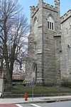 | August 11, 1976 (#76000229) | Roughly bounded by Acushnet, Page, Middle, and Bedford Sts. (both sides) 41°37′55″N 70°55′55″W / 41.631944°N 70.931944°W / 41.631944; -70.931944 (County Street Historic District) | |
7 | Dawson Building | 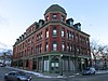 | September 30, 1982 (#82001900) | 1851 Purchase St. 41°39′N 70°56′W / 41.65°N 70.93°W / 41.65; -70.93 (Dawson Building) | |
8 | Thomas Donaghy School |  | March 2, 1989 (#89000041) | 68 South St. 41°37′33″N 70°55′25″W / 41.625833°N 70.923611°W / 41.625833; -70.923611 (Thomas Donaghy School) | |
9 | ERNESTINA (schooner) |  | January 3, 1985 (#85000022) | Steamship Wharf 41°38′01″N 70°55′16″W / 41.633611°N 70.921111°W / 41.633611; -70.921111 (ERNESTINA (schooner)) | |
10 | Fire Station No. 4 | 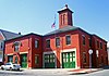 | July 24, 1975 (#75000250) | 79 S. 6th St. 41°37′41″N 70°55′38″W / 41.628056°N 70.927222°W / 41.628056; -70.927222 (Fire Station No. 4) | 1867 building was oldest fire station in state when closed; now home of New Bedford Fire Museum |
11 | First Baptist Church |  | April 21, 1975 (#75000251) | 149 William St. 41°38′06″N 70°55′44″W / 41.635°N 70.928889°W / 41.635; -70.928889 (First Baptist Church) | |
12 | Fort Taber District |  | February 8, 1973 (#73001954) | Wharf Rd. within Fort Rodman Military Reservation 41°35′36″N 70°54′14″W / 41.593333°N 70.903889°W / 41.593333; -70.903889 (Fort Taber District) | |
13 | Griffin Street Cemetery |  | March 19, 2014 (#14000062) | S. 2nd & Griffin Sts. 41°37′42″N 70°55′22″W / 41.628323°N 70.922738°W / 41.628323; -70.922738 (Griffin Street Cemetery) | |
14 | Hazelwood Park |  | June 24, 2010 (#10000389) | 597-603 Brock Ave. 41°36′24″N 70°54′48″W / 41.606667°N 70.913333°W / 41.606667; -70.913333 (Hazelwood Park) | |
15 | Head of the River Historic District |  | December 2, 2009 (#09000965) | 2-28 Mill Rd., 2-13 Tarkiln Hill Rd. 41°40′54″N 70°55′09″W / 41.681736°N 70.919186°W / 41.681736; -70.919186 (Head of the River Historic District) | Extends into Acushnet. |
16 | Hotel Waverly |  | January 26, 1990 (#89002326) | 1162-1166 Acushnet Ave. 41°39′26″N 70°55′38″W / 41.657222°N 70.927222°W / 41.657222; -70.927222 (Hotel Waverly) | |
17 | Howland Mill Village Historic District |  | May 30, 1996 (#96000609) | Roughly bounded by Bolton, Winsper, Hemlock Sts., and Rockdale Ave. 41°36′58″N 70°56′00″W / 41.616111°N 70.933333°W / 41.616111; -70.933333 (Howland Mill Village Historic District) | |
18 | Robert C. Ingraham School |  | March 2, 2010 (#10000056) | 80 Rivet St. 41°37′14″N 70°55′20″W / 41.6206°N 70.9223°W / 41.6206; -70.9223 (Robert C. Ingraham School) | |
19 | Jewish Cemetery |  | April 15, 2014 (#14000155) | Old Plainville Road 41°40′51″N 70°58′01″W / 41.6808°N 70.9670°W / 41.6808; -70.9670 (Jewish Cemetery) | |
20 | Nathan and Mary Johnson Properties | 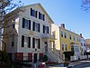 | February 16, 2000 (#00000260) | 17-19 and 21 7th Street 41°37′59″N 70°55′44″W / 41.633056°N 70.928889°W / 41.633056; -70.928889 (Nathan and Mary Johnson Properties) | National Historic Landmark; home and meetinghouse of African-American abolitionist couple who took in Frederick Douglass after he escaped from slavery |
21 | Lightship No. 114 | 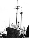 | May 30, 1990 (#90000777) | formerly State Pier 41°38′08″N 70°55′16″W / 41.635556°N 70.921111°W / 41.635556; -70.921111 (Lightship No. 114) | Scrapped. |
22 | Manomet Mills |  | May 24, 2012 (#12000304) | 194-194R, 200 Riverside Ave. 41°40′03″N 70°55′12″W / 41.667494°N 70.920035°W / 41.667494; -70.920035 (Manomet Mills) | |
23 | Merrill's Wharf Historic District |  | November 11, 1977 (#77000167) | MacArthur Dr. 41°37′59″N 70°55′15″W / 41.633056°N 70.920833°W / 41.633056; -70.920833 (Merrill's Wharf Historic District) | Encompasses Steamship Pier and adjacent Coal Pocket Pier. |
24 | Moreland Terrace Historic District |  | June 3, 1996 (#96000610) | Roughly bounded by Moreland Terrace, Ash, Bedford, and Page Sts. 41°37′40″N 70°56′11″W / 41.627778°N 70.936389°W / 41.627778; -70.936389 (Moreland Terrace Historic District) | |
25 | New Bedford Gas and Edison Light Complex |  | June 3, 2002 (#02000633) | 180 MacAuthur Dr. 41°37′49″N 70°55′16″W / 41.630278°N 70.921111°W / 41.630278; -70.921111 (New Bedford Gas and Edison Light Complex) | |
26 | New Bedford Historic District |  | November 13, 1966 (#66000773) | Bounded by Front St. on the east, Elm St. on the north, Acushnet Ave. on the west, and Commercial St. on the south 41°38′07″N 70°55′27″W / 41.635278°N 70.924167°W / 41.635278; -70.924167 (New Bedford Historic District) | National Historic Landmark |
27 | New Bedford Whaling National Historical Park |  | November 12, 1996 (#03000283) | 33 William St. 41°38′08″N 70°55′27″W / 41.635692°N 70.924064°W / 41.635692; -70.924064 (New Bedford Whaling National Historical Park) | |
28 | North Bedford Historic District |  | September 19, 1979 (#00000899) | Roughly bounded by Summer, Park, Pleasant, and Kempton Sts. 41°38′25″N 70°55′49″W / 41.640278°N 70.930278°W / 41.640278; -70.930278 (North Bedford Historic District) | |
29 | Oak Grove Cemetery |  | April 28, 2014 (#14000176) | Parker St. 41°38′37″N 70°56′32″W / 41.6437°N 70.9422°W / 41.6437; -70.9422 (Oak Grove Cemetery) | |
30 | Old Third District Courthouse |  | September 28, 1971 (#71000083) | 2nd and William Sts. 41°38′09″N 70°55′29″W / 41.635833°N 70.924722°W / 41.635833; -70.924722 (Old Third District Courthouse) | |
31 | Palmer Island Light Station |  | March 26, 1980 (#80000433) | New Bedford Harbor 41°37′34″N 70°54′35″W / 41.626111°N 70.909722°W / 41.626111; -70.909722 (Palmer Island Light Station) | ARLHS USA-578 |
32 | William J. Rotch Gothic Cottage |  | February 17, 2006 (#06000236) | 19 Irving St. 41°37′50″N 70°55′55″W / 41.630494°N 70.931811°W / 41.630494; -70.931811 (William J. Rotch Gothic Cottage) | |
33 | William Rotch Jr. House | 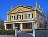 | April 5, 2005 (#05000456) | 396 County Street 41°37′49″N 70°55′43″W / 41.630297°N 70.928686°W / 41.630297; -70.928686 (William Rotch Jr. House) | Early Richard Upjohn house for prominent whaling family |
34 | Rural Cemetery and Friends Cemetery |  | April 28, 2014 (#14000177) | 149 Dartmouth St. 41°37′22″N 70°56′07″W / 41.6229°N 70.9354°W / 41.6229; -70.9354 (Rural Cemetery and Friends Cemetery) | |
35 | Shawmut Diner | 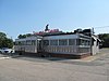 | November 28, 2003 (#03001208) | 943 Shawmut Ave. 41°39′32″N 70°56′51″W / 41.658889°N 70.9475°W / 41.658889; -70.9475 (Shawmut Diner) | |
36 | Bradford Smith Building |  | May 17, 1984 (#84002216) | 1927-1941 Purchase St. 41°39′04″N 70°55′49″W / 41.651111°N 70.930278°W / 41.651111; -70.930278 (Bradford Smith Building) | Demolished.[5] |
37 | Thompson Street School |  | January 26, 1990 (#89002329) | 58 Crapo St. 41°37′17″N 70°55′37″W / 41.621389°N 70.926944°W / 41.621389; -70.926944 (Thompson Street School) | |
38 | Times and Olympia Buildings | 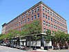 | July 7, 1983 (#83000725) | 908-912 and 880-898 Purchase St. 41°38′11″N 70°55′36″W / 41.636389°N 70.926667°W / 41.636389; -70.926667 (Times and Olympia Buildings) | |
39 | U.S. Customhouse |  | December 30, 1970 (#70000735) | Southwestern corner of 2nd and Williams Sts. 41°38′07″N 70°55′29″W / 41.635278°N 70.924722°W / 41.635278; -70.924722 (U.S. Customhouse) | Oldest U.S. Customs facility in continuous use; Greek Revival public building by Robert Mills |
40 | Union Baptist Church |  | June 16, 2008 (#08000532) | 109 Court St. 41°38′03″N 70°56′05″W / 41.634181°N 70.934775°W / 41.634181; -70.934775 (Union Baptist Church) | |
41 | Union Street Railway Carbarn, Repair Shop |  | October 2, 1978 (#78000431) | 1959 Purchase St. 41°39′07″N 70°55′52″W / 41.651944°N 70.931111°W / 41.651944; -70.931111 (Union Street Railway Carbarn, Repair Shop) | |
42 | Wamsutta Mills |  | August 19, 2008 (#08000794) | Acushnet Ave., Logan, Wamsutta, and N. Front St. 41°39′05″N 70°55′39″W / 41.651479°N 70.927627°W / 41.651479; -70.927627 (Wamsutta Mills) | |
43 | Whitman Mills | 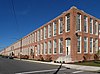 | August 29, 2003 (#03000844) | 1, 90, and the eastern side of Riverside Ave., rear 1 and the southern and northern sides of Coffin Ave., and 10 Manomet St. 41°39′45″N 70°55′10″W / 41.6625°N 70.919444°W / 41.6625; -70.919444 (Whitman Mills) |
Former listings[edit]
| [2] | Name on the Register | Image | Date listed | Date removed | Location | Summary |
|---|---|---|---|---|---|---|
1 | Rotch Counting House | Unknown (#71001103) | 1972 | 123 Front St. | Demolished for construction of the JFK Memorial Parkway in downtown New Bedford.[6] |
See also[edit]
| Wikimedia Commons has media related to National Register of Historic Places in New Bedford, Massachusetts. |
- List of National Historic Landmarks in Massachusetts
References[edit]
^ https://www.nps.gov/subjects/nationalregister/weekly-list.htm "National Register of Historic Places: Weekly List Actions"]. National Park Service, United States Department of the Interior. Retrieved on October 4, 2018.
^ ab Numbers represent an ordering by significant words. Various colorings, defined here, differentiate National Historic Landmarks and historic districts from other NRHP buildings, structures, sites or objects.
^ National Park Service (2008-04-24). "National Register Information System". National Register of Historic Places. National Park Service..mw-parser-output cite.citation{font-style:inherit}.mw-parser-output q{quotes:"""""""'""'"}.mw-parser-output code.cs1-code{color:inherit;background:inherit;border:inherit;padding:inherit}.mw-parser-output .cs1-lock-free a{background:url("//upload.wikimedia.org/wikipedia/commons/thumb/6/65/Lock-green.svg/9px-Lock-green.svg.png")no-repeat;background-position:right .1em center}.mw-parser-output .cs1-lock-limited a,.mw-parser-output .cs1-lock-registration a{background:url("//upload.wikimedia.org/wikipedia/commons/thumb/d/d6/Lock-gray-alt-2.svg/9px-Lock-gray-alt-2.svg.png")no-repeat;background-position:right .1em center}.mw-parser-output .cs1-lock-subscription a{background:url("//upload.wikimedia.org/wikipedia/commons/thumb/a/aa/Lock-red-alt-2.svg/9px-Lock-red-alt-2.svg.png")no-repeat;background-position:right .1em center}.mw-parser-output .cs1-subscription,.mw-parser-output .cs1-registration{color:#555}.mw-parser-output .cs1-subscription span,.mw-parser-output .cs1-registration span{border-bottom:1px dotted;cursor:help}.mw-parser-output .cs1-hidden-error{display:none;font-size:100%}.mw-parser-output .cs1-visible-error{font-size:100%}.mw-parser-output .cs1-subscription,.mw-parser-output .cs1-registration,.mw-parser-output .cs1-format{font-size:95%}.mw-parser-output .cs1-kern-left,.mw-parser-output .cs1-kern-wl-left{padding-left:0.2em}.mw-parser-output .cs1-kern-right,.mw-parser-output .cs1-kern-wl-right{padding-right:0.2em}
^ The eight-digit number below each date is the number assigned to each location in the National Register Information System database, which can be viewed by clicking the number.
^ "Cultural Inventory Record for Bradford Smith Building". Commonwealth of Massachusetts. Retrieved 2013-10-16.
^ [1]
U.S. National Register of Historic Places in Massachusetts | |||||||||||||||||
|---|---|---|---|---|---|---|---|---|---|---|---|---|---|---|---|---|---|
| Topics |
|  | |||||||||||||||
| Lists by county |
| ||||||||||||||||
| Lists by city |
| ||||||||||||||||
| Other lists |
| ||||||||||||||||
| |||||||||||||||||
Boston (capital) | |
| Topics |
|
| Society |
|
| Regions |
|
| Counties |
|
| Cities |
|
Categories:
- New Bedford, Massachusetts
- Lists of National Register of Historic Places in Massachusetts by populated place
- Lists of National Register of Historic Places by city
- National Register of Historic Places in New Bedford, Massachusetts
(window.RLQ=window.RLQ||).push(function(){mw.config.set({"wgPageParseReport":{"limitreport":{"cputime":"0.828","walltime":"1.125","ppvisitednodes":{"value":17784,"limit":1000000},"ppgeneratednodes":{"value":0,"limit":1500000},"postexpandincludesize":{"value":322932,"limit":2097152},"templateargumentsize":{"value":26767,"limit":2097152},"expansiondepth":{"value":11,"limit":40},"expensivefunctioncount":{"value":0,"limit":500},"unstrip-depth":{"value":1,"limit":20},"unstrip-size":{"value":7835,"limit":5000000},"entityaccesscount":{"value":1,"limit":400},"timingprofile":["100.00% 751.810 1 -total"," 50.71% 381.233 44 Template:NRHP_row"," 24.28% 182.530 1 Template:Commons_category"," 12.25% 92.096 1 Template:NRHP_header"," 11.97% 89.960 87 Template:First_word"," 10.55% 79.342 44 Template:Designation/color"," 10.25% 77.029 43 Template:Coord"," 10.08% 75.765 2 Template:Cite_web"," 9.84% 73.963 1 Template:NRISref"," 8.55% 64.258 44 Template:Dts"]},"scribunto":{"limitreport-timeusage":{"value":"0.248","limit":"10.000"},"limitreport-memusage":{"value":3578290,"limit":52428800}},"cachereport":{"origin":"mw1330","timestamp":"20181013213016","ttl":1900800,"transientcontent":false}}});mw.config.set({"wgBackendResponseTime":1234,"wgHostname":"mw1330"});});

 Clash Royale CLAN TAG

