Wheeler Ridge, California
Wheeler Ridge, California
Jump to navigation
Jump to search
| Wheeler Ridge | |
|---|---|
Unincorporated community | |
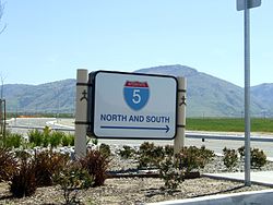 Highway directional sign in Wheeler Ridge, with Tehachapi Mountains beyond | |
 Wheeler Ridge Location in California Show map of California  Wheeler Ridge Wheeler Ridge (the US) Show map of the US | |
Coordinates: 35°00′16″N 118°56′58″W / 35.00444°N 118.94944°W / 35.00444; -118.94944Coordinates: 35°00′16″N 118°56′58″W / 35.00444°N 118.94944°W / 35.00444; -118.94944 | |
| Elevation[1] | 291 m (955 ft) |
Wheeler Ridge is an unincorporated community in the southwestern San Joaquin Valley, within Kern County, California.[1] It is at the junction of the valley floor and the Wheeler Ridge landform of the Tehachapi Mountains.
Contents
1 Geography
2 History
2.1 Earthquakes
3 See also
4 References
Geography[edit]
The community is located at the Wheeler Ridge Interchange, the junction of State Route 99 and Interstate 5. It is 4.25 miles (6.8 km) south-southeast of Mettler, and west of Arvin.[2]
Wheeler Ridge is at an elevation of 955 feet (291 m).[1]
Street addresses in Wheeler Ridge are addressed as "Arvin, CA 93203" when east of Interstate 5, and as "Lebec, CA 93243" when west of Interstate 5.[3] The community is inside area code 661.
History[edit]
A post office operated at Wheeler Ridge from 1923 to 1972.[2]
Before the development of the Grapevine commercial district to the south on Interstate 5, Wheeler Ridge had the last services southbound on U.S. Route 99 and I−5 before the steep 3,000 feet (910 m) climb up Tejon Pass. Before the 1964 state highway renumbering, old Route 99 passed through Wheeler Ridge.
Earthquakes[edit]
The epicenter of the magnitude 7.3 1952 Kern County earthquake (White Wolf earthquake), on the White Wolf Fault, was at Wheeler Ridge.
The settlement is north of the San Andreas Fault, which passes through the Sierra Pelona Mountains in the Tejon Pass area. Its last major event in the area was the magnitude 7.9 1857 Fort Tejon earthquake.
On April 16, 2005, a magnitude 5.2 earthquake on the White Wolf Fault struck near Wheeler Ridge.
See also[edit]
- Tejon Hills
- Tejon Ranch
References[edit]
^ abc U.S. Geological Survey Geographic Names Information System: Wheeler Ridge, California
^ ab Durham, David L. (1998). California's Geographic Names: A Gazetteer of Historic and Modern Names of the State. Clovis, Calif.: Word Dancer Press. p. 1126. ISBN 1-884995-14-4..mw-parser-output cite.citation{font-style:inherit}.mw-parser-output q{quotes:"""""""'""'"}.mw-parser-output code.cs1-code{color:inherit;background:inherit;border:inherit;padding:inherit}.mw-parser-output .cs1-lock-free a{background:url("//upload.wikimedia.org/wikipedia/commons/thumb/6/65/Lock-green.svg/9px-Lock-green.svg.png")no-repeat;background-position:right .1em center}.mw-parser-output .cs1-lock-limited a,.mw-parser-output .cs1-lock-registration a{background:url("//upload.wikimedia.org/wikipedia/commons/thumb/d/d6/Lock-gray-alt-2.svg/9px-Lock-gray-alt-2.svg.png")no-repeat;background-position:right .1em center}.mw-parser-output .cs1-lock-subscription a{background:url("//upload.wikimedia.org/wikipedia/commons/thumb/a/aa/Lock-red-alt-2.svg/9px-Lock-red-alt-2.svg.png")no-repeat;background-position:right .1em center}.mw-parser-output .cs1-subscription,.mw-parser-output .cs1-registration{color:#555}.mw-parser-output .cs1-subscription span,.mw-parser-output .cs1-registration span{border-bottom:1px dotted;cursor:help}.mw-parser-output .cs1-hidden-error{display:none;font-size:100%}.mw-parser-output .cs1-visible-error{font-size:100%}.mw-parser-output .cs1-subscription,.mw-parser-output .cs1-registration,.mw-parser-output .cs1-format{font-size:95%}.mw-parser-output .cs1-kern-left,.mw-parser-output .cs1-kern-wl-left{padding-left:0.2em}.mw-parser-output .cs1-kern-right,.mw-parser-output .cs1-kern-wl-right{padding-right:0.2em}
^ http://www.zipmap.net/California/Kern_County.htm
Municipalities and communities of Kern County, California, United States | ||
|---|---|---|
County seat: Bakersfield | ||
| Cities |
|  |
| CDPs |
| |
| Unincorporated communities |
| |
| Former settlements |
| |
This Kern County, California-related article is a stub. You can help Wikipedia by expanding it. |
Categories:
- Unincorporated communities in Kern County, California
- Unincorporated communities in California
- 1923 establishments in California
- Kern County, California geography stubs
(window.RLQ=window.RLQ||).push(function(){mw.config.set({"wgPageParseReport":{"limitreport":{"cputime":"0.540","walltime":"0.641","ppvisitednodes":{"value":2769,"limit":1000000},"ppgeneratednodes":{"value":0,"limit":1500000},"postexpandincludesize":{"value":97847,"limit":2097152},"templateargumentsize":{"value":22137,"limit":2097152},"expansiondepth":{"value":13,"limit":40},"expensivefunctioncount":{"value":2,"limit":500},"unstrip-depth":{"value":1,"limit":20},"unstrip-size":{"value":4020,"limit":5000000},"entityaccesscount":{"value":1,"limit":400},"timingprofile":["100.00% 536.323 1 -total"," 69.22% 371.262 1 Template:Infobox_settlement"," 50.27% 269.585 1 Template:Infobox"," 16.08% 86.217 1 Template:Reflist"," 13.58% 72.854 1 Template:California's_Geographic_Names"," 13.31% 71.384 1 Template:Cite_book"," 7.65% 41.006 1 Template:Short_description"," 7.26% 38.922 5 Template:Both"," 7.25% 38.901 3 Template:Convert"," 6.69% 35.894 1 Template:Coord"]},"scribunto":{"limitreport-timeusage":{"value":"0.311","limit":"10.000"},"limitreport-memusage":{"value":4951777,"limit":52428800}},"cachereport":{"origin":"mw1272","timestamp":"20181101153347","ttl":1900800,"transientcontent":false}}});mw.config.set({"wgBackendResponseTime":103,"wgHostname":"mw1258"});});

 Clash Royale CLAN TAG

