Red Bluff, California
Red Bluff, California
Jump to navigation
Jump to search
| City of Red Bluff | |
|---|---|
City | |
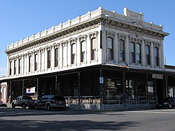 Historic downtown building (2009) | |
Motto(s): "A Great Place To Live" | |
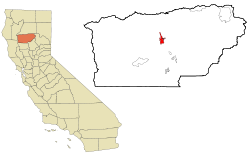 Location in California (left) and Tehama County (right) | |
 City of Red Bluff Location in the United States Show map of the US  City of Red Bluff City of Red Bluff (California) Show map of California | |
Coordinates: 40°10′36″N 122°14′17″W / 40.17667°N 122.23806°W / 40.17667; -122.23806Coordinates: 40°10′36″N 122°14′17″W / 40.17667°N 122.23806°W / 40.17667; -122.23806 | |
| Country | United States |
| State | California |
| County | Tehama |
| Incorporated | March 31, 1876[1] |
| Area[2] | |
| • City | 7.68 sq mi (19.88 km2) |
| • Land | 7.56 sq mi (19.59 km2) |
| • Water | 0.11 sq mi (0.30 km2) 1.48% |
| Elevation[3] | 305 ft (93 m) |
| Population (2010)[4] | |
| • City | 14,076 |
| • Estimate (2016)[5] | 14,158 |
| • Density | 1,872.01/sq mi (722.83/km2) |
| • Urban[citation needed] | 18,434 |
| Time zone | UTC-8 (Pacific (PST)) |
| • Summer (DST) | UTC-7 (PDT) |
| ZIP code | 96080 |
| Area code | 530 |
| FIPS code | 06-59892 |
GNIS feature IDs | 277581, 2411527 |
| Website | Official website |
Red Bluff is a city in and the county seat of Tehama County, California, United States.[6] The population was 14,076 at the 2010 census, up from 13,147 at the 2000 census.
It is located 131 miles (211 kilometers) north of Sacramento, 31 miles (50 km) south of Redding, and it is bisected by Interstate 5. Red Bluff is situated on the banks of the upper Sacramento River.
It was originally known as Leodocia, but was renamed to Covertsburg in 1853. It got its current name in 1854.[7]
Contents
1 Geography
2 History
3 Climate
4 Demographics
4.1 2010
4.2 2000
5 Top employers
6 Events
6.1 News
7 Newspapers
8 Notable people
9 References
10 External links
Geography[edit]
Red Bluff is on the northern edge of the Sacramento Valley, and is the third largest city in the Shasta Cascade region. It is about 31 miles (50 km) south of Redding, 40 miles (64 km) northwest of Chico, and 131 miles (211 km) north of Sacramento.
The city is located at 40°10′36″N 122°14′17″W / 40.17667°N 122.23806°W / 40.17667; -122.23806 (40.176640, -122.237951).[8] According to the United States Census Bureau, the city has a total area of 7.7 square miles (20 square kilometers). 7.6 square miles (20 km2) of it is land and 0.1 square miles (0.26 km2) of it is water. The total area is 1.48% water.
History[edit]
A post office called Red Bluff has been in operation since 1853.[9] The community was named for the red bluffs along the nearby Sacramento River.[10]
Climate[edit]
Red Bluff has a Mediterranean climate (Csa) with cool, wet winters and hot, dry summers. There are an average of 100.1 days annually with highs of 90 °F (32.2 °C) or higher and an average of 21.5 days with lows of 32 °F (0 °C) or lower. The record highest temperature was 121 °F (49.4 °C) on August 7, 1981, and the record lowest temperature was 17 °F (−8.3 °C) on January 9, 1937. Annual precipitation averages 23.21 inches (589.5 mm) with measurable precipitation falling on an average of 71 days. The wettest “rain year” was from July 1994 to June 1995 with 45.96 inches (1,167.4 mm) and the driest from July 1975 to June 1976 with 10.17 inches (258.3 mm). The most rainfall in one month was 21.47 inches (545.3 mm) in January 1995 and the most rainfall in 24 hours was 3.55 inches (90.2 mm) on January 8, 1995. The most snowfall in one month was 15.0 inches (0.38 m) in January 1937.
| Climate data for Red Bluff, California (Red Bluff Municipal Airport), 1981–2010 normals | |||||||||||||
|---|---|---|---|---|---|---|---|---|---|---|---|---|---|
| Month | Jan | Feb | Mar | Apr | May | Jun | Jul | Aug | Sep | Oct | Nov | Dec | Year |
| Record high °F (°C) | 80 (27) | 85 (29) | 92 (33) | 98 (37) | 108 (42) | 117 (47) | 119 (48) | 121 (49) | 118 (48) | 107 (42) | 93 (34) | 83 (28) | 121 (49) |
| Average high °F (°C) | 54.9 (12.7) | 60.0 (15.6) | 64.9 (18.3) | 71.2 (21.8) | 81.1 (27.3) | 90.0 (32.2) | 97.2 (36.2) | 95.7 (35.4) | 90.0 (32.2) | 78.2 (25.7) | 62.7 (17.1) | 54.3 (12.4) | 75.0 (23.9) |
| Average low °F (°C) | 37.9 (3.3) | 40.7 (4.8) | 43.6 (6.4) | 47.0 (8.3) | 54.3 (12.4) | 61.7 (16.5) | 65.6 (18.7) | 63.0 (17.2) | 58.8 (14.9) | 51.2 (10.7) | 42.3 (5.7) | 37.5 (3.1) | 50.3 (10.2) |
| Record low °F (°C) | 17 (−8) | 21 (−6) | 26 (−3) | 28 (−2) | 33 (1) | 42 (6) | 51 (11) | 50 (10) | 41 (5) | 30 (−1) | 24 (−4) | 13 (−11) | 13 (−11) |
| Average precipitation inches (mm) | 5.02 (127.5) | 4.06 (103.1) | 3.20 (81.3) | 1.56 (39.6) | 1.22 (31) | 0.47 (11.9) | 0.11 (2.8) | 0.13 (3.3) | 0.50 (12.7) | 1.21 (30.7) | 2.85 (72.4) | 4.16 (105.7) | 24.49 (622) |
| Average snowfall inches (cm) | 0.4 (1) | 0 (0) | 0 (0) | 0 (0) | 0 (0) | 0 (0) | 0 (0) | 0 (0) | 0 (0) | 0 (0) | 0 (0) | 0.7 (1.8) | 1.1 (2.8) |
| Average precipitation days (≥ 0.01 in) | 11.1 | 9.9 | 9.8 | 6.5 | 5.0 | 2.5 | 0.4 | 0.6 | 1.6 | 4.1 | 8.6 | 10.8 | 70.9 |
| Average snowy days (≥ 0.1 in) | 0.3 | 0.1 | 0 | 0 | 0 | 0 | 0 | 0 | 0 | 0 | 0 | 0.3 | 0.7 |
| Mean monthly sunshine hours | 165.1 | 195.2 | 267.8 | 328.8 | 396.3 | 404.4 | 436.9 | 397.5 | 344.0 | 281.4 | 172.1 | 153.4 | 3,542.9 |
| Source #1: NOAA [11] | |||||||||||||
| Source #2: [12] | |||||||||||||
Demographics[edit]
| Historical population | |||
|---|---|---|---|
| Census | Pop. | %± | |
| 1870 | 992 | — | |
| 1880 | 2,106 | 112.3% | |
| 1890 | 2,608 | 23.8% | |
| 1900 | 2,750 | 5.4% | |
| 1910 | 3,530 | 28.4% | |
| 1920 | 3,104 | −12.1% | |
| 1930 | 3,517 | 13.3% | |
| 1940 | 3,824 | 8.7% | |
| 1950 | 4,905 | 28.3% | |
| 1960 | 7,202 | 46.8% | |
| 1970 | 7,676 | 6.6% | |
| 1980 | 9,490 | 23.6% | |
| 1990 | 12,363 | 30.3% | |
| 2000 | 13,147 | 6.3% | |
| 2010 | 14,076 | 7.1% | |
| Est. 2016 | 14,158 | [5] | 0.6% |
| U.S. Decennial Census[13] | |||
2010[edit]
The 2010 United States Census[14] reported that Red Bluff had a population of 14,076. The population density was 1,833.6 people per square mile (708.0/km²). The racial makeup of Red Bluff was 11,366 (80.7%) White, 128 (0.9%) African American, 438 (3.1%) Native American, 187 (1.3%) Asian, 16 (0.1%) Pacific Islander, 1,168 (8.3%) from other races, and 773 (5.5%) from two or more races. Hispanic or Latino of any race were 3,037 persons (21.6%).
The Census reported that 13,637 people (96.9% of the population) lived in households, 150 (1.1%) lived in non-institutionalized group quarters, and 289 (2.1%) were institutionalized.
There were 5,376 households, out of which 2,033 (37.8%) had children under the age of 18 living in them, 1,969 (36.6%) were opposite-sex married couples living together, 1,022 (19.0%) had a female householder with no husband present, 404 (7.5%) had a male householder with no wife present. There were 537 (10.0%) unmarried opposite-sex partnerships, and 27 (0.5%) same-sex married couples or partnerships. 1,629 households (30.3%) were made up of individuals and 678 (12.6%) had someone living alone who was 65 years of age or older. The average household size was 2.54. There were 3,395 families (63.2% of all households); the average family size was 3.11.
The population was spread out with 3,950 people (28.1%) under the age of 18, 1,534 people (10.9%) aged 18 to 24, 3,561 people (25.3%) aged 25 to 44, 3,157 people (22.4%) aged 45 to 64, and 1,874 people (13.3%) who were 65 years of age or older. The median age was 32.2 years. For every 100 females, there were 92.4 males. For every 100 females age 18 and over, there were 87.7 males.
There were 5,872 housing units at an average density of 764.9 per square mile (295.3/km²), of which 2,277 (42.4%) were owner-occupied, and 3,099 (57.6%) were occupied by renters. The homeowner vacancy rate was 3.5%; the rental vacancy rate was 7.3%. 5,652 people (40.2% of the population) lived in owner-occupied housing units and 7,985 people (56.7%) lived in rental housing units.
2000[edit]

Cone & Kimball Plaza clocktower
As of the census[15] of 2000, there were 13,147 people, 5,109 households, and 3,239 families residing in the city. The population density was 1,768.7 people per square mile (683.2/km²). There were 5,567 housing units at an average density of 748.9 per square mile (289.3/km²). The racial makeup of the city was 86.7% White, 0.6% Black, 2.2% Native American, 1.6% Asian, 0.1% Pacific Islander, 5.8% from other races, and 3.0% from two or more races. Hispanic or Latino of any race were 13.7% of the population.[16]
There were 5,109 households out of which 36.2% had children under the age of 18 living with them, 42.4% were married couples living together, 16.5% had a female householder with no husband present, and 36.6% were non-families. 30.7% of all households were made up of individuals and 14.0% had someone living alone who was 65 years of age or older. The average household size was 2.47 and the average family size was 3.07.
In the city, the population was spread out with 28.7% under the age of 18, 9.9% from 18 to 24, 28.6% from 25 to 44, 18.0% from 45 to 64, and 14.7% who were 65 years of age or older. The median age was 34 years. For every 100 females, there were 90.1 males. For every 100 females age 18 and over, there were 84.1 males.
The median income for a household in the city was $27,029, and the median income for a family was $32,799. Males had a median income of $26,807 versus $21,048 for females. The per capita income for the city was $14,060. About 17.7% of families and 21.1% of the population were below the poverty line, including 29.6% of those under age 18 and 9.7% of those age 65 or over.
Top employers[edit]
According to the city's 2016 Comprehensive Annual Financial Report (CAFR),[17] these are the top-10 employers:
| # | Employer | # of employees |
|---|---|---|
| 1 | Walmart | 1,350 |
| 2 | County of Tehama | 740 |
| 3 | Saint Elizabeth Community Hospital | 477 |
| 4 | Red Bluff Union Elementary School District | 265 |
| 5 | Tehama County Department of Education | 219 |
| 6 | Red Bluff Joint Union High School District | 210 |
| 7 | City of Red Bluff | 156 |
| 8 | Raley's Supermarkets | 128 |
| 9 | The Home Depot | 111 |
| 10 | Lassen Medical Clinic | 110 |
Events[edit]
This section does not cite any sources. (July 2016) (Learn how and when to remove this template message) |
- The annual Red Bluff Round-Up, first held in 1921, has become one of the west's largest rodeos. The town is well known throughout the nation due to its popular bull competitions.
TehamaPulse.com is an online events calendar for Tehama County, including Red Bluff.
News[edit]
This section needs additional citations for verification. (November 2017) (Learn how and when to remove this template message) |
- Red Bluff's Little League 11–12 year old All-Star baseball team was the Northern California State Champions and the runner up in the 2011 Little League All-Star west region. The team played twice on television, ESPN and ESPN 2. After the tournament the team was honored by the San Francisco Giants for winning the Northern California Championship.
- Red Bluff's Little League 9-10 year old All-Star baseball team placed fourth in the state of California in the 2002 California Little League All-Star tournament
- Red Bluff's Little League 11–12 year old All-Star baseball team was the United States Little League Champion and the runner-up in the 1974 Little League World Series
- On April 30, 1984, the Cone & Kimball building in downtown Red Bluff burned down. A park with a new clock tower was built on its lot in 2007.
- In late 1984, it was discovered that Colleen Stan had been kept as a sex slave on Weed Court since 1977, without anyone outside her abductors household knowing
- On November 19, 2002, Andrew Mickel shot and killed Officer David Mobilio of the Red Bluff Police Department in an attempt to make a political statement against "corporate irresponsibility" and the government's "police-state tactics". The case brought national media attention to Red Bluff.[18]
- On November 14, 2017, Saint Elizabeth Community Hospital in Red Bluff treated several victims of the Rancho Tehama Reserve shootings[19]
Newspapers[edit]
- Red Bluff Daily News
- The Redding Record Searchlight runs a weekly publication called Tehama Today for Red Bluff residents. It is included in the Sunday editions of the Record Searchlight.
Notable people[edit]
Clancy Barone, offensive line coach for the National Football League
Chuck Cecil, former National Football League safety
Michael Chiarello, celebrity chef
Jim Davis, Major League Baseball pitcher for the Giants, Cubs and Cardinals. In 1956, he became the first pitcher in 40 years to record four strikeouts in a single inning
Shane Drake, award-winning music video director
Clair Engle, former United States Senator, was known as "The Pride of Red Bluff"
Jesse Freitas Sr., American football player.
Al Geiberger, 1966 PGA Championship winner, was born here
Gale Gilbert, NFL quarterback
Margaret Glaspy, Singer-Songwriter
Leo Gorcey, stage and movie actor
Marv Grissom, Major League Baseball player
Jim Hanks, voice and character actor (brother of Tom Hanks)
William B. Ide, who joined the Bear Flag Revolt and was named President of the California Republic
Roy Joiner, Major League Baseball pitcher of 1930s
Bill Redell, former Occidental College quarterback and College Football Hall of Fame member
Swede Risberg, baseball player banned after Black Sox Scandal, died in Red Bluff
Jeff Serr, radio personality and voice actor
Robert Shaw, choral conductor
References[edit]
^ "California Cities by Incorporation Date". California Association of Local Agency Formation Commissions. Archived from the original (Word) on November 3, 2014. Retrieved August 25, 2014..mw-parser-output cite.citation{font-style:inherit}.mw-parser-output q{quotes:"""""""'""'"}.mw-parser-output code.cs1-code{color:inherit;background:inherit;border:inherit;padding:inherit}.mw-parser-output .cs1-lock-free a{background:url("//upload.wikimedia.org/wikipedia/commons/thumb/6/65/Lock-green.svg/9px-Lock-green.svg.png")no-repeat;background-position:right .1em center}.mw-parser-output .cs1-lock-limited a,.mw-parser-output .cs1-lock-registration a{background:url("//upload.wikimedia.org/wikipedia/commons/thumb/d/d6/Lock-gray-alt-2.svg/9px-Lock-gray-alt-2.svg.png")no-repeat;background-position:right .1em center}.mw-parser-output .cs1-lock-subscription a{background:url("//upload.wikimedia.org/wikipedia/commons/thumb/a/aa/Lock-red-alt-2.svg/9px-Lock-red-alt-2.svg.png")no-repeat;background-position:right .1em center}.mw-parser-output .cs1-subscription,.mw-parser-output .cs1-registration{color:#555}.mw-parser-output .cs1-subscription span,.mw-parser-output .cs1-registration span{border-bottom:1px dotted;cursor:help}.mw-parser-output .cs1-hidden-error{display:none;font-size:100%}.mw-parser-output .cs1-visible-error{font-size:100%}.mw-parser-output .cs1-subscription,.mw-parser-output .cs1-registration,.mw-parser-output .cs1-format{font-size:95%}.mw-parser-output .cs1-kern-left,.mw-parser-output .cs1-kern-wl-left{padding-left:0.2em}.mw-parser-output .cs1-kern-right,.mw-parser-output .cs1-kern-wl-right{padding-right:0.2em}
^ "2016 U.S. Gazetteer Files". United States Census Bureau. Archived from the original on August 24, 2017. Retrieved June 28, 2017.
^ "Red Bluff". Geographic Names Information System. United States Geological Survey. Retrieved November 20, 2014.
^ "Red Bluff (city) QuickFacts". United States Census Bureau. Archived from the original on January 25, 2012. Retrieved February 9, 2015.
^ ab "Population and Housing Unit Estimates". Archived from the original on May 29, 2017. Retrieved June 9, 2017.
^ "Find a County". National Association of Counties. Archived from the original on May 31, 2011. Retrieved June 7, 2011.
^ Capace, Nancy (1999). Encyclopedia of California. North American Book Dist LLC. Page 386.
ISBN 9780403093182.
^ "US Gazetteer files: 2010, 2000, and 1990". United States Census Bureau. February 12, 2011. Archived from the original on March 12, 2012. Retrieved April 23, 2011.
^ "Post Offices". Jim Forte Postal History. Retrieved 26 March 2018.
^ "Place Names" (PDF). Tehama County Department of Education. p. 45. Archived from the original (PDF) on 8 May 2017. Retrieved 25 March 2018.
^ "NowData – NOAA Online Weather Data". National Oceanic and Atmospheric Administration. Archived from the original on September 20, 2012. Retrieved May 4, 2012.
^ "RED BLUFF FSS, CALIFORNIA Period of Record General Climate Summary – Temperature". NOAA. Archived from the original on July 15, 2014.
^ "Census of Population and Housing". Census.gov. Archived from the original on May 12, 2015. Retrieved June 4, 2015.
^ "2010 Census Interactive Population Search: CA – Red Bluff city". U.S. Census Bureau. Retrieved July 12, 2014.
^ "American FactFinder". United States Census Bureau. Archived from the original on September 11, 2013. Retrieved January 31, 2008.
^ "96080 Zip Code (Red Bluff, California) Profile – homes, apartments, schools, population, income, averages, housing, demographics, location, statistics, sex offenders, residents and real estate info". www.city-data.com. Archived from the original on January 16, 2017. Retrieved November 19, 2017.
^ "City Of Red Bluff, California Comprehensive Annual Financial Report For The Fiscal Year Ended June 30, 2016" (PDF). cityofredbluff.org. June 30, 2016. Archived (PDF) from the original on November 20, 2017. Retrieved November 19, 2017.
^ Booth, William (April 4, 2005). "Murder, Incorporated?". Washington Post.
^ Schultz, Jim (November 14, 2017). "Shooter identified as 44-year-old man who had problems with neighbors". Redding Record Searchlight. USA Today. Retrieved November 19, 2017.
External links[edit]
| Wikimedia Commons has media related to Red Bluff, California. |
Official website
 Red Bluff travel guide from Wikivoyage
- Red Bluff Union High School
Images of Red Bluff from the Eastman's Originals Collection, Special Collections Dept., University of California, Davis.- Red Bluff Police Department
Shasta Cascade | ||
|---|---|---|
| Mountains |
|  |
| Bodies of Water |
| |
| Rivers |
| |
| Incorporated Cities |
| |
| Counties |
| |
| Parks |
| |
Municipalities and communities of Tehama County, California, United States | ||
|---|---|---|
County seat: Red Bluff | ||
| Cities |
|  |
| CDPs |
| |
| Unincorporated communities |
| |
| Footnotes | ‡This populated place also has portions in an adjacent county or counties | |
Authority control |
|
|---|
Categories:
- Red Bluff, California
- 1876 establishments in California
- Cities in Tehama County, California
- County seats in California
- Geography of the Sacramento Valley
- Incorporated cities and towns in California
- Populated places established in 1876
- Populated places on the Sacramento River
- Shasta Cascade
(window.RLQ=window.RLQ||).push(function(){mw.config.set({"wgPageParseReport":{"limitreport":{"cputime":"0.916","walltime":"1.121","ppvisitednodes":{"value":7986,"limit":1000000},"ppgeneratednodes":{"value":0,"limit":1500000},"postexpandincludesize":{"value":208481,"limit":2097152},"templateargumentsize":{"value":17912,"limit":2097152},"expansiondepth":{"value":16,"limit":40},"expensivefunctioncount":{"value":9,"limit":500},"unstrip-depth":{"value":1,"limit":20},"unstrip-size":{"value":51414,"limit":5000000},"entityaccesscount":{"value":1,"limit":400},"timingprofile":["100.00% 872.169 1 -total"," 35.61% 310.609 1 Template:Infobox_settlement"," 25.45% 221.936 1 Template:Infobox"," 24.70% 215.397 1 Template:Reflist"," 16.62% 144.926 16 Template:Cite_web"," 7.72% 67.311 1 Template:Weather_box"," 5.66% 49.381 18 Template:Convert"," 4.47% 38.952 1 Template:US_Census_population"," 4.44% 38.700 1 Template:Short_description"," 4.39% 38.268 7 Template:Both"]},"scribunto":{"limitreport-timeusage":{"value":"0.363","limit":"10.000"},"limitreport-memusage":{"value":9710976,"limit":52428800}},"cachereport":{"origin":"mw1274","timestamp":"20181026202535","ttl":1900800,"transientcontent":false}}});mw.config.set({"wgBackendResponseTime":123,"wgHostname":"mw1268"});});

 Clash Royale CLAN TAG

